Robotic ImagingMarch 22, 2023
LiDAR imaging is a fascinating technology that allows us to scan an area and create a 3D model. After being used by NASA to map the Moon, LiDAR has entered many other fields of work including architecture, engineering and construction. How does it work exactly? When should we use a drone for LiDAR instead of traditional measurement techniques? These are just some of the questions we hope this article has answered for you. In short, drones make it easy for project owners to get more out of their projects by using drone-based LiDAR scanning.
LiDAR imaging is a fascinating technology that allows us to scan an area and create a 3D model. LiDAR, which stands for Light Detection And Ranging, is a remote sensing method that uses light in the form of a pulsed laser to measure ranges (variable distances) and can be used with a variety of targets. LiDAR has been used since the 1970s, but only recently has become more advanced and available to commercial interests. LiDAR imaging is an exciting technology that allows us to scan an area and create a 3D model of what's there—from buildings down to individual trees.
In fact, LiDAR was first developed in the late 1960s by a group of NASA scientists who were trying to figure out how they could accurately measure distances between Earth-orbiting satellites. It wasn't until 1984 when a scientist named James Tootell published his findings on how this technology could be used as an alternative method for mapping urban areas, as opposed to traditional plane or helicopter-mounted cameras. Since then there has been an explosion in applications for LiDAR scanning: everything from measuring buildings' heights or detecting hazardous materials under roads has been done with this technology.
Suggested reading: If you want to learn more about how to optimize your workflows with LiDAR Scanning, check out this article.
How Does It Work Exactly?
A drone equipped with a LiDAR sensor is able to measure the distance between itself and objects around it by firing pulses of light at them. The sensor then measures how long it takes for these pulses to bounce back, which allows it to calculate how far away they are from the drone. The data collected by this process can be processed into 3D models. The concept of LiDAR imaging dates back to World War II, when German scientists developed an airborne version of radar that could detect enemy aircraft by bouncing radio waves off them. Today's commercial versions use light instead of radio waves and are more commonly known as "LiDAR" —a portmanteau combining "light" with "radar."
When Should We Use a Drone for LiDAR Instead of Traditional Measurement Techniques?
The use of drones for LiDAR scanning is becoming increasingly popular due to the benefits it offers over traditional techniques. The main benefit is cost, which is often significantly lower than other methods. In addition, drone-based surveying can be completed much more quickly and safely than traditional methods such as ground-based or airborne laser scanning (ALS). Furthermore, drones make it easy for project owners to get more out of their projects by using drone-based LiDAR scanning.
Overall, the benefits include:
- Faster data collection, which means less time spent on site, and more time analyzing data in the office.
- A wider range of applications, including aerial surveys and mapping areas that were previously inaccessible or difficult to reach by ground crews.
- The ability for drone operators to take measurements from above ground level (rather than having their heads down in a trench). This means they can gather more accurate information about what's happening below them--and it also makes them safer!
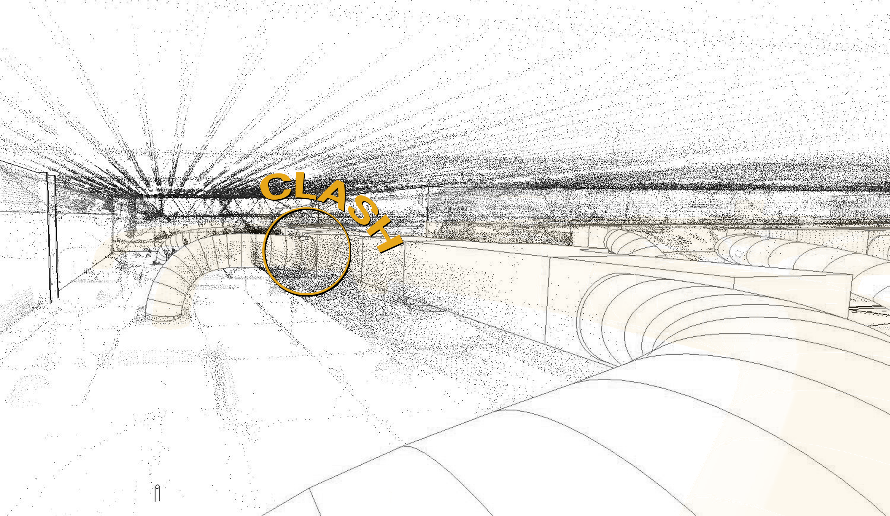
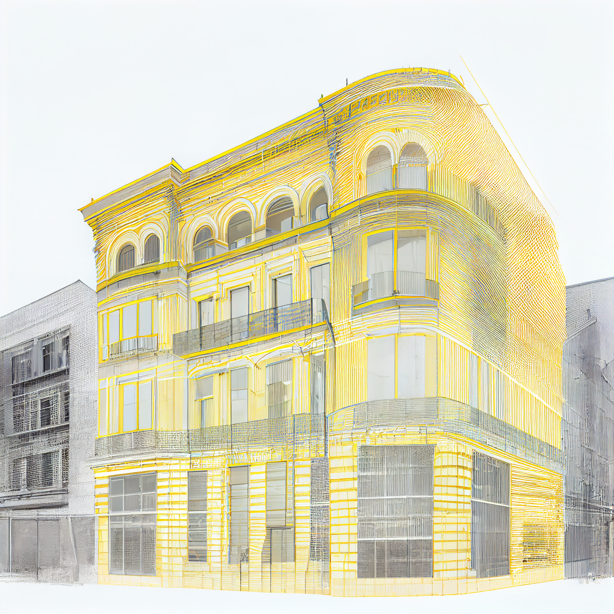
Understanding LiDAR and Its Place in the Architecture Industry
LiDAR, or Light Detection and Ranging, is a laser-based remote sensing technology that can be used to create 3D models of objects and environments. LiDAR is the reason you can see the world in incredible detail on Google Earth or Apple Maps. Similar to radar and sonar technologies, LiDAR sensors send out pulses (previously discussed in the earlier paragraphs) of light waves which bounce off surfaces before returning back to their source. The time it takes for these waves to return allows technicians to calculate how far away each object is from them—and therefore build up a precise picture of what's going on around them.
In architecture, this means that buildings can be scanned in a level of high detail. Afterwards, this data can be translated and replicated in virtual reality environments like Second Life or OpenSimulator, the open source alternative. More realistically, scan-to-BIM projects completed by Robotic Imaging specializes in digitizing as-built conditions for AEC professionals.
Overall, LiDAR imaging is a fascinating technology that allows professionals like Robotic Imaging to scan an area and create a 3D model.