Answers, with the numbers attached.
What it costs, how accurate it is, what lands in your hands, and what keeps the record true after the technician drives away. If an answer here is vague, treat that as a defect and tell us.
30 questions · 7 sections · no gated answers
01
Getting started and scheduling
One site is a real starting point. The portfolio conversation is easier after the first set than before it.
What is the fastest way to start?
Pick the single location that costs you the most in guesswork and let us capture that one. A certified technician dispatches nationally in two to three days, raw spatial data is back inside 24 hours of the visit, and the full deliverable set lands in 10 to 14 business days.
Nothing about the first site commits you to the next one. Volume pricing applies once a program covers multiple locations, which means the portfolio conversation is a much better conversation to have with one finished set on the table.
How is Managed Capture different from Enabled Capture?
Who holds the camera. Managed Capture is our field teams establishing the ground-truth baseline with survey-grade hardware. Enabled Capture is your own store teams keeping that baseline current with the phone already in their pocket.
They are two entry points to one record, not two products. Most portfolios use both: Managed Capture to establish the truth, Enabled Capture to keep it true.
How quickly can a technician be on site?
Two to three days, nationwide. Scheduling runs 24/7 through the mobile app rather than through an email thread, so a site can be booked outside business hours and dispatched against a real technician calendar.
Most retail locations are a single day on site. Larger industrial and infrastructure sites run one to three days.
Which markets do you cover?
All of them, nationwide, including drone work. Aerial captures are flown by FAA Part 107 certified pilots and are available in every market we serve.
The company was founded in Philadelphia and New York City in 2017 and is now headquartered in Miami, with a team of 51 to 200 and 135 enterprise portfolios under documentation.
02
On site
What actually happens during the visit, which instrument gets used, and what we do about the rooms with no signal.
How long does a capture take on site?
One to three days depending on size and complexity, and most retail locations fall in the one-day range. Raw spatial data is delivered inside 24 hours of the visit as an interim drop, so nobody waits on the full set to start planning.
End to end the process runs 50 to 80 percent faster than traditional surveying and documentation alternatives, at roughly 10 times traditional documentation speed.
Which instrument gets used on our site?
Whichever one the job needs. Hardware is matched to the building rather than to a price list, and we are a Verified Matterport Service Provider and a Verified Leica Hardware Partner, so the fleet is the real fleet rather than a rental of convenience.
| Instrument | Points per second | Range | Where it goes |
|---|---|---|---|
| Matterport Pro3 | 100,000 | Interior | 3D walkthroughs, .E57 compliance API |
| Leica BLK 360 G2 | 680,000 | 0.5m to 45m | Retail foundation |
| Leica P50 | 1,000,000 | 0.4m to 1km | Long range |
| Leica RTC 360 | 2,000,000 | 0.5m to 130m | Industrial foundation, survey control |
Can you capture the roof and the exterior?
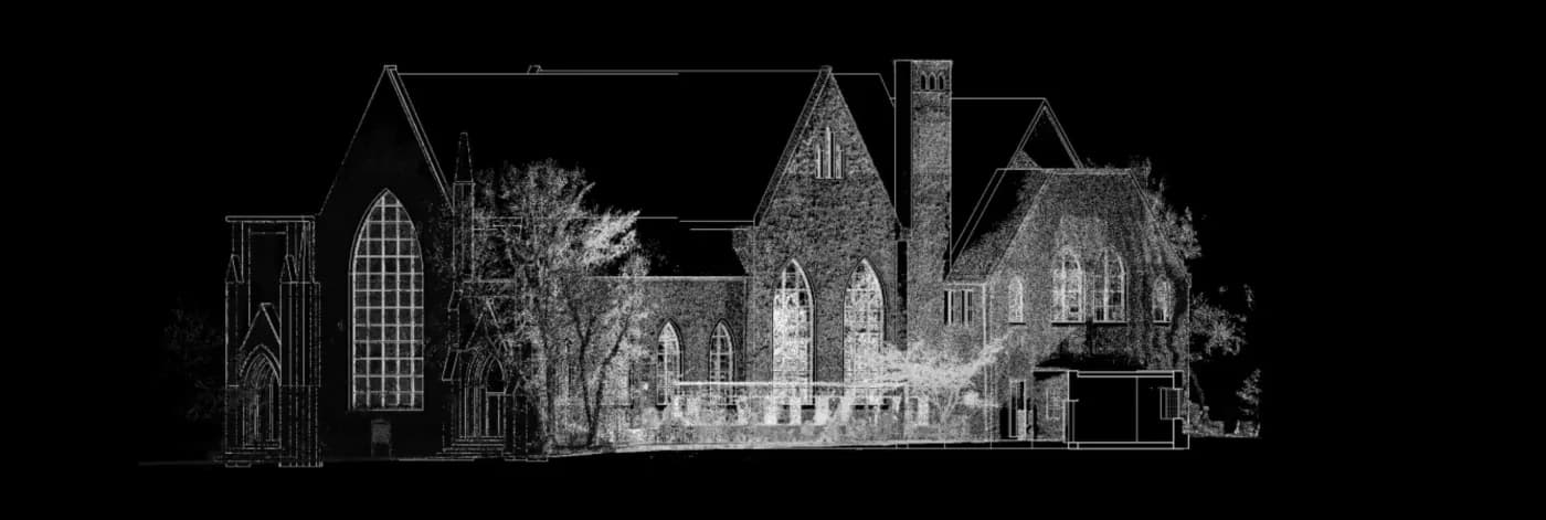
Yes, by drone, flown by FAA Part 107 certified pilots. Standard aerial deliverables are orthomosaic maps, 3D models and thermal imagery, and drone data comes back three to five hours after the site visit.
High-resolution and thermal sensors make it straightforward to identify defects, structural issues or potential problems on retail roofs and construction sites without putting anyone on a ladder. DroneDeploy integrations are supported.
What about back of house, where there is no signal?
RI Capture works fully offline on iOS and Android. That is a deliberate design decision, not a fallback: basement mechanical rooms, freezer rooms and concrete-walled back-of-house spaces are where signal drops are routine and where the equipment you care about actually lives.
Capture continues offline and syncs when the phone reconnects. The pattern has been run across a 1,000-plus store deployment at 7-Eleven, which is where the offline caching and sync behaviour was proven against genuinely diverse connectivity.
03
Accuracy and verification
The numbers, the conditions under which they hold, and who checks the work before it reaches you.
How accurate is the point cloud?
Plus or minus two to four millimetres across the fleet, and plus or minus two millimetres on the Leica RTC 360. That is roughly 10 times more accurate than traditional manual measurement, and it is the measurement every other deliverable descends from.
The honest qualification, which is theirs and worth repeating: those figures are 3D point accuracy from controlled manufacturer testing. Real-world results vary slightly with surface reflectivity, ambient lighting and site conditions on the day.
How close is the model to the point cloud?
A LOD 200 model sits within a quarter of an inch of the cloud it was built from. Line work is extracted from the measurement rather than traced from a drawing that was already wrong, which is the difference between an as-built and a redrawn guess.
LOD 400 is available on request where fabrication needs it.
| LOD | Geometry | Information | Accuracy |
|---|---|---|---|
| 200 · Basic detail | Adequate | Minimal | Adequate |
| 300 · Standard detail | Precise | Adequate | Precise |
| 350 · High detail | Exact | Precise | Exact |
How accurate is the AI nameplate extraction?
85 to 90 percent on nameplate photographs from day one, and past 90 percent by month twelve as the model tunes to your own equipment population. Against manual entry it is 30 to 60 times faster.
The fields that come off a nameplate are the ones a capital plan needs: manufacturer, model number, serial number, installation date, refrigerant type, charge amount and electrical specifications.
What is the context layer?
Automation is only as good as its context, so extracted equipment is matched against manufacturer catalogues, including discontinued lines recovered through the Wayback Machine. It started with HVAC and now extends to electrical and custom equipment.
That match is what turns a serial number into a maintainable asset with a known service life, which is the difference between an inventory and a forecast.
Who checks the work before we see it?
Automated QA/QC checks run on every delivery, and a QA Reviewer step sits in the platform ahead of handover.
Coverage is tracked rather than assumed: Project Data Completeness is reported per site, so you can see which locations are fully documented and which still have gaps instead of finding out during a capital review.
04
Deliverables and formats
Exactly what arrives, in which formats, and whether it opens in the software your team already runs.
What files do we actually receive?
The whole chain, not a viewer link. Every format below comes off the same capture, so a point cloud, a Revit model and a dimensioned PDF are the same measurement in three materials rather than three separate exercises.
- Point clouds
- RCS, RCP, E57, LAS
- Scan to BIM
- RVT, IFC, SKP at LOD 200, 300, 350. LOD 400 on request
- Scan to CAD
- DWG, DXF, PDF, layered and dimensioned
- Walkthroughs
- 360 degree virtual tours and VR, Matterport based
- Aerial
- Orthomosaic maps, 3D models, thermal roof imagery
- Asset registers
- CSV, XLSX
- Programmatic
- Robotic Imaging API, Partner API v1, real-time webhooks
Which drawings are in the set?
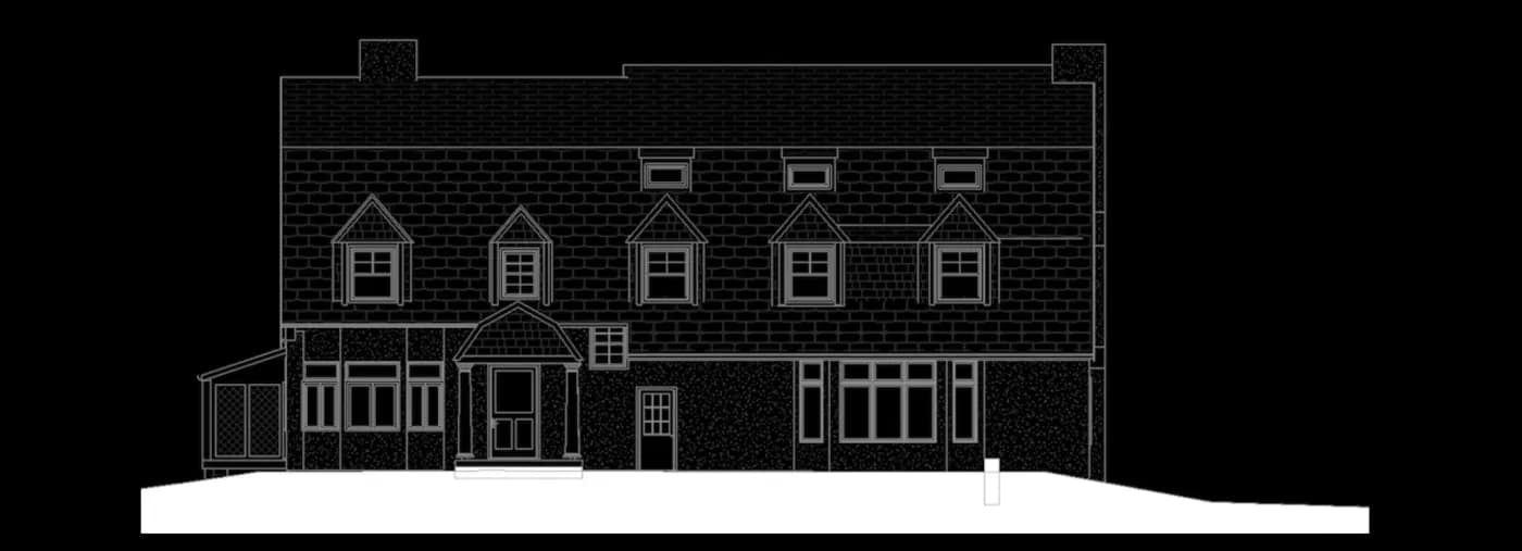
Floor plans, reflected ceiling plans, elevations, sections, roof plans and MEP routing documentation, layered and dimensioned.
All of it is extracted from the point cloud. That matters most on buildings whose existing as-builts date from the 1990s and no longer match the field, which is the single most common reason a design team pays for a second site visit.
Does it work with the software we already run?
Yes. RCS and RCP go straight into Autodesk ReCap, and deliverables are compatible with AutoCAD, Revit, Navisworks and the rest of the AEC stack. Aerial work integrates with DroneDeploy.
On the platform side there is an open API with real-time webhooks, Partner API v1, and delivery into CMMS systems so triage is prioritised with real data. Enterprise programs add SSO and SAML, white label, and a dedicated customer success manager.
Can we get our data back out?
Always. Easy data exports and unlimited user access are on every tier, asset registers come out as CSV and XLSX, and open API access is available on Enterprise.
A record you cannot export is not your record, it is a vendor archive you are renting. The point of a verified record is that you own it.
05
Keeping the record current
A static scan starts going stale the day it is captured. This section is the answer to that.
What actually stops the record going stale?
The people already standing in the building. Enabled Capture turns a store team into the sensor network: a 90-second video walk, five to ten seconds per equipment item, about 30 seconds for a store manager to document one unit.
Layout and asset drift is then flagged automatically, so decisions run on the reality of today instead of a spreadsheet and a set of old drawings.
Who does the capturing?
Your own teams, with zero-training field onboarding. The design constraint was blunt: if you can capture a video, you can use the app. No survey background, no equipment, no scheduling.
RI Capture is free on iOS and Android. Simplifying capture down to video is what took throughput from hundreds of sites a week to thousands.
What happens to a 90-second video?
The ingestion pipeline eats it and updates the building immediately. Nameplates are read, assets are updated, compliance is audited, and the result feeds your work-order system without anyone filing anything.
What comes out is every RTU, panel and fixture with make, model and serial number attached, against a record that already knows where in the building each one sits.
How does a technician find an asset in the field?
QR labels are applied at documentation time and cost one to five cents each. Scanning one surfaces the asset age, its specifications, its service history, its warranty position, and how that unit compares against the same unit in other stores.
RI Facilities handles QR and barcode scanning, nameplate capture and verification, and asset image capture, on iOS and Android.
Does this replace our CMMS?
No, and it is not trying to. In their own words: it is not a CMMS, it is an operations portfolio management platform where equipment status exists as one layer of a broader store performance view.
Platforms like ServiceChannel, Limble and UpKeep were built to serve maintenance teams and they do that well. None of them answers an operations director asking how equipment condition maps onto store performance. The record feeds your CMMS rather than competing with it.
06
Pricing
Capture is priced per square foot and published. Platform pricing is quoted per portfolio.
What does capture cost?
From $0.35 / sq ft for 3D scanning with standard VR delivery, FAA certified drone captures, clean CAD and Revit exports and automated QA/QC checks.
From $0.75 / sq ft for Scan to BIM: high-fidelity RVT, IFC and SKP at LOD 200 to 400, structured asset registers as CSV and XLSX, standardised onboarding and BIM delivery, and raw spatial data inside 24 hours. Volume pricing applies for multi-location programs.
What does the platform cost?
Platform pricing is quoted per portfolio, because the variable is location count rather than seats. Two tiers are published.
Starter is the verified asset baseline: mobile app capture, zero-training field onboarding, the full property asset record, easy data exports and unlimited user access. Enterprise adds operational governance and automated dispatch: the native maintenance and triage app, vendor management and smart dispatch, continuous cloud sync and hygiene, and open API access.
How does this pay for itself?
By deleting spend you are already committed to. A single architect site visit runs $1,500 and up, which is a $300,000 problem across 200 stores before design work has even started. A professional per-location audit runs $5,000 to $15,000 and is the only systematic capture most portfolios have.
On a 100-store portfolio that is $500,000 to $1.5M of documentation spend replaced, against net annual value of $600,000 and up. Payback on the platform lands under two months, which is why it is best evaluated as a financial decision tool rather than an IT operating expense.
Does better data actually reduce capital spend?
It reduces the wrong capital spend. A retail CFO approving $8M or more of equipment capital a year usually has limited ability to independently verify what needs replacing, when, or why.
One $8.5M request, checked against a documented record, validated at $7.2M with $1.3M rejected as still inside useful life. Documented portfolios typically take 10 to 20 percent out of facilities capital requests, support 80 percent plus confidence intervals on a five-year forecast, and surface things like the $680,000 a year of energy saved by replacing 15-year-old refrigeration across 100 stores.
07
Security and procurement
What your security reviewer will ask for, and how quickly your procurement team can raise a purchase order.
How is our data protected?
Everything stored about you and your properties is encrypted with industry-standard encryption, and in transit everything runs on TLS 1.2 or higher. Row-level security restricts account data visibility, and MFA is mandatory on all internal systems.
On the engineering side: secrets live in cloud provider tooling and never in source code, test and production environments are fully isolated, every change goes through mandatory peer review with AI-assisted review from CodeRabbit, automated unit tests run on all changes, and end-to-end tests run in dedicated test environments. Monitoring and alerting are continuous.
What compliance can you evidence?
SOC 2 Type I, with GDPR and CCPA. Governance and compliance are backed by PwC and Ballard Spahr.
Send security questionnaires and documentation requests to security@roboticimaging.com and they go to the team that owns the controls rather than into a sales queue.
- Attestations
- SOC 2 Type I
- Privacy
- GDPR, CCPA
- In transit
- TLS 1.2 or higher
- Access
- Row-level security, MFA on all internal systems
- Advisors
- PwC, Ballard Spahr
Are you already in our procurement system?
Probably. Robotic Imaging is an approved supplier on Coupa, which for most enterprise buyers turns onboarding into a purchase order rather than a new-vendor process.
The company is 100 percent founder-owned, operates with zero debt and is funded entirely through operations, so there is no financing event and no outside pressure to explain in a vendor risk review.
How do we know the platform is up, and what changed?
There is a public status page, and release notes ship every two weeks. A recent cycle carried seven new features, four improvements and four fixes, including a Dashboard Agent, Partner API v1, QA Reviewer improvements, Property Status and PDF reports, a Deficiencies Gallery, Site Attributes search and Project Data Completeness tracking.
Underneath, the platform runs 25 AI edge functions covering health scoring, failure prediction, anomaly detection, voice transcription and OCR extraction, at sub-100ms response times.
Still not answered
Ask the specific version of your question.
If the question is specific to your portfolio, the answer usually is too. Tell us one location and what you need out of it, and we will come back with a per square foot number and a date rather than a discovery call.
Contact→- Security questionnaires
- security@roboticimaging.com
Start with one site
Book a capture.
Tell us one location. We will dispatch a certified technician in two to three days and you will have raw spatial data inside 24 hours.
- Coverage
- All 50 states
- Entry price
- $0.35 / sq ft
- Security
- SOC 2 Type I
- Release cadence
- Every two weeks