Scan-to-BIM vs Traditional Surveying: Cost & Speed

Robotic ImagingMarch 13, 2026
Scan-to-BIM vs Traditional Surveying: Cost, Speed, and Accuracy
Choosing between Scan-to-BIM Laser Scanning and Traditional Surveying for existing conditions documentation is a cost-timeline-accuracy tradeoff — not a technology preference. For commercial office projects, the decision hinges on project size, geometry complexity, and deliverable requirements. This comparison breaks down both methodologies by cost per square foot, field capture duration, accuracy tolerances, and deliverable formats to help construction project managers and architects select the right approach.
Neither method is universally superior. Traditional Surveying remains appropriate for small, simple scopes. Scan-to-BIM services deliver compounding value as project complexity and square footage increase. Understanding where each method excels — and where it falls short — is the foundation for making a defensible methodology decision.
Choosing the Right Documentation Method
When project teams evaluate scan-to-BIM vs traditional surveying, the instinct is often to frame the decision as old versus new. That framing misses the point. The real question is: what does your project actually need from its existing conditions documentation?
Three variables drive the decision:
- Project size — square footage determines whether laser scanning's upfront setup costs are offset by per-SF efficiency gains
- Geometry complexity — irregular floor plates, ornate facades, complex MEP systems, and multi-story structures amplify the cost of manual measurement errors
- Deliverable requirements — if downstream design work requires a Revit BIM model, traditional surveying cannot produce that deliverable without an additional conversion step
For straightforward single-room punch list documentation under 2,000 SF, a tape measure and skilled drafter may genuinely be the fastest path. For multi-floor commercial renovations, tenant improvement programs, or any scope where rework costs are significant, the calculation shifts quickly.
How Traditional Surveying Works — And Where It Falls Short
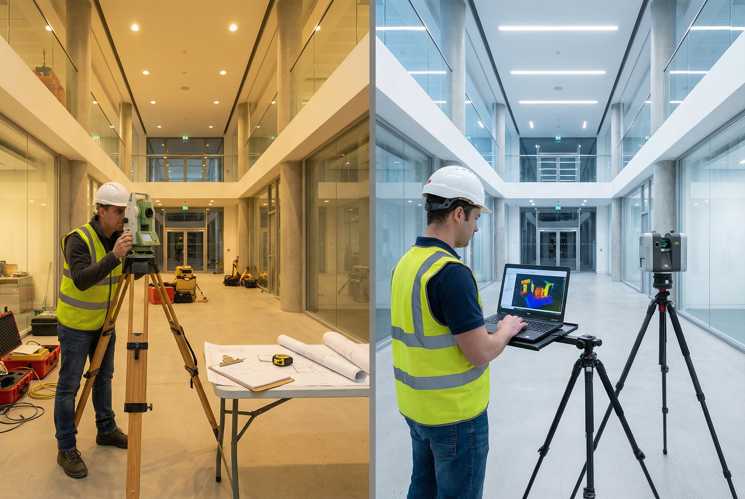
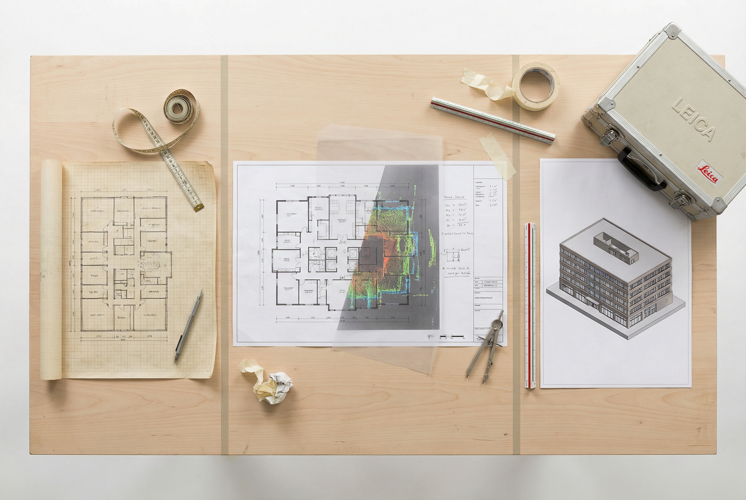
Traditional Surveying for building documentation typically involves a field team using total stations, measuring tapes, and manual sketches to capture dimensions, elevations, and spatial relationships. That data is then transcribed into 2D CAD drawings — typically AutoCAD .dwg files — delivered 3-5 weeks after fieldwork begins.
The methodology is proven. For simple rectangular spaces, it produces serviceable documentation at predictable cost. However, it carries structural limitations that compound on larger or more complex projects.
Accuracy tolerance for manual field measurement runs ±1-3 inches depending on the surveyor's methodology and the complexity of the space. In straight-corridor office layouts, that tolerance is workable. In spaces with curved walls, mechanical rooms, or tight coordination between structural and MEP systems, a 2-inch error in the as-built documentation can generate change orders that dwarf the original survey cost.
Hidden costs rarely appear in the survey line item but appear predictably in the construction budget:
- Repeat field visits when initial measurements are found incomplete during design development
- Transcription errors converting field notes to CAD (a manual step with no error-checking mechanism)
- Change orders during construction when as-built documentation doesn't match actual field conditions
- Occupied building disruption costs when surveyors need extended floor access across 1-2 weeks
The deliverable limitation is structural: Traditional Surveying produces 2D CAD drawings only. If the project later requires a BIM model, point cloud data, or a 360° documentation archive, a new field capture must be commissioned.
How Scan-to-BIM Laser Scanning Works
Scan-to-BIM Laser Scanning uses terrestrial laser scanners to capture millions of precise spatial measurements per second from multiple positions throughout a building. Each scan position generates a dense "Point Cloud" — a three-dimensional dataset of every visible surface within the scanner's range. After field capture, point cloud registration combines individual scan positions into a unified, spatially accurate model of the entire building.
That registered point cloud then serves as the source geometry for BIM model production in Revit, 2D CAD drafting in AutoCAD, and the generation of multiple derivative formats — all from a single field capture event.
Laser scanning advantages relevant to commercial documentation include:
- Capture speed: The LEICA RTC 360 scans at 2,000,000 points per second with ±1/16 inch accuracy at 130m range — capturing more spatial data from a single position in seconds than a survey crew can manually record in hours
- Accuracy: ±2-4mm (±1/16 to ±1/4 inch) depending on equipment and application — compared to ±1-3 inches for manual methods
- Multi-format output from one visit: Point Cloud files (RCS, RCP, E57, LAS), Revit BIM models at LOD 200 through LOD 400, 2D CAD .dwg drawings, and 360° VR Tours are all derivable from a single field capture
- Reduced site access time: Field capture typically completes in 2-3 days versus 1-2 weeks for traditional teams covering equivalent square footage
Cost Comparison: Per-SF Pricing and Break-Even Analysis
How much does scan-to-BIM cost compared to traditional surveying per square foot?
Scan-to-BIM costs $0.10–$0.40 per SF for LOD 300 deliverables, completing in 10-14 days total. Traditional Surveying costs $0.50–$2.00 per SF, taking 3-5 weeks for comparable documentation. Scan-to-BIM becomes cost-competitive at 5,000–10,000 SF and delivers 3D BIM models, point cloud data, and 2D CAD from a single field capture — versus 2D CAD drawings only from traditional methods.
| Factor | Traditional Surveying | Scan-to-BIM Laser Scanning |
|---|---|---|
| Cost per SF | $0.50–$2.00 | $0.10–$0.40 |
| Break-even threshold | Competitive under 5,000 SF | Cost-competitive at 5,000–10,000 SF+ |
| Field crew rate | $75–$150/hr (approximate) | Equipment + processing bundled |
| Rework risk | High (manual transcription) | Low (point cloud source of truth) |
| Hidden cost exposure | Change orders, repeat visits | Minimal — single capture |
| Deliverable value | 2D CAD only | BIM + Point Cloud + CAD + VR Tours |
The per-SF cost gap narrows when hidden costs are included in the traditional surveying total. A single change order on a commercial renovation project — traced to inaccurate as-built documentation — routinely costs $5,000–$50,000 depending on scope. That exposure rarely appears in methodology cost comparisons but is the most significant financial differentiator at scale.
Timeline Comparison: Field Capture to Final Deliverable
The timeline gap between laser scanning vs manual survey is most visible in the field capture phase, but it compounds through delivery.
| Phase | Traditional Surveying | Scan-to-BIM Laser Scanning |
|---|---|---|
| Field capture | 1-2 weeks | 2-3 days |
| Processing / drafting | 2-3 weeks | 7-10 days |
| Total delivery | 3-5 weeks | 10-14 days |
| Revision cycles | Common (field gaps) | Rare (complete point cloud) |
Robotic Imaging, for example, completes field capture in 2-3 days using the LEICA RTC 360 — with total delivery from capture to final CAD/BIM deliverables in 10-14 days. For occupied commercial buildings where floor access must be scheduled around business operations, compressing site time from 1-2 weeks to 2-3 days meaningfully reduces tenant disruption costs.
The revision cycle difference is practically significant. Traditional surveys frequently require return field visits when designers discover unmeasured conditions during design development. A complete point cloud eliminates that gap — every surface captured in the original scan remains queryable without returning to the building.
Accuracy and Deliverable Format Comparison
How accurate is laser scanning compared to traditional surveying?
The LEICA RTC 360 achieves ±1/16 inch (±2mm) accuracy. The LEICA BLK 360 achieves ±1/4 inch (±4mm) — both substantially tighter than the ±1-3 inch tolerance range typical of manual measurement methods. For projects with MEP coordination requirements, curtain wall systems, or tight dimensional tolerances, the accuracy gap is not theoretical — it directly affects whether the design model will coordinate cleanly with actual field conditions.
Deliverable format comparison is where the methodology gap is most pronounced:
| Deliverable | Traditional Surveying | Scan-to-BIM |
|---|---|---|
| 2D CAD (.dwg) | ✓ | ✓ |
| Revit BIM model (LOD 200–LOD 400) | ✗ | ✓ |
| Point Cloud (RCS, RCP, E57, LAS) | ✗ | ✓ |
| 360° VR Tour | ✗ | ✓ |
| Permanent spatial archive | ✗ | ✓ |
Traditional Surveying produces one deliverable. Scan-to-BIM services produce all formats from a single field capture — and the Point Cloud archive remains available indefinitely for future project phases, facility management, or downstream renovation planning.
Recommendation Framework: Which Method Fits Your Project
Use this decision checklist to match methodology to project requirements:
Traditional Surveying is appropriate when:
- Project scope is under 3,000–5,000 SF with simple rectangular geometry
- Deliverable requirement is 2D CAD only, with no BIM model needed downstream
- Budget is highly constrained and rework risk is low
- Single-visit access is reliable and the space is unoccupied
Scan-to-BIM Laser Scanning is the right choice when:
- Project exceeds 5,000–10,000 SF (break-even threshold)
- Geometry is complex: irregular floor plates, multi-story, curved surfaces, or dense MEP systems
- Downstream deliverables require Revit BIM at LOD 300 or above
- Occupied building access must be minimized
- Point Cloud archive has future value (portfolio documentation, facility management, multi-phase renovation)
- Project is part of a multi-location program requiring standardized documentation
A hybrid approach works best when: a project combines a straightforward primary scope (traditional surveying sufficient) with specific high-complexity zones — mechanical penthouses, ornate lobby features, or tight coordination areas — where laser scanning accuracy is warranted only in targeted areas.
For large commercial documentation programs, the scan-to-BIM ROI case is well-documented. Providers like Robotic Imaging, which has documented 100+ million square feet for Fortune 500 clients including Kroger, 7-Eleven, and Ross, demonstrate how Scan-to-BIM scales effectively for multi-location portfolios where consistent documentation standards across hundreds of locations make manual surveying operationally impractical.
The break-even logic is straightforward: at 10,000 SF, the per-SF cost advantage of Scan-to-BIM versus Traditional Surveying can represent $4,000–$16,000 in direct cost savings — before accounting for change order risk reduction, faster project timelines, and the multi-format deliverable value from a single field capture. For most commercial renovation and tenant improvement projects above 5,000 SF, the methodology decision is less a question of budget and more a question of how much project risk is acceptable in the documentation phase.