What Is Laser Scanning for Buildings? Simple Guide
Robotic ImagingMarch 17, 2026
What is Laser Scanning for Buildings?
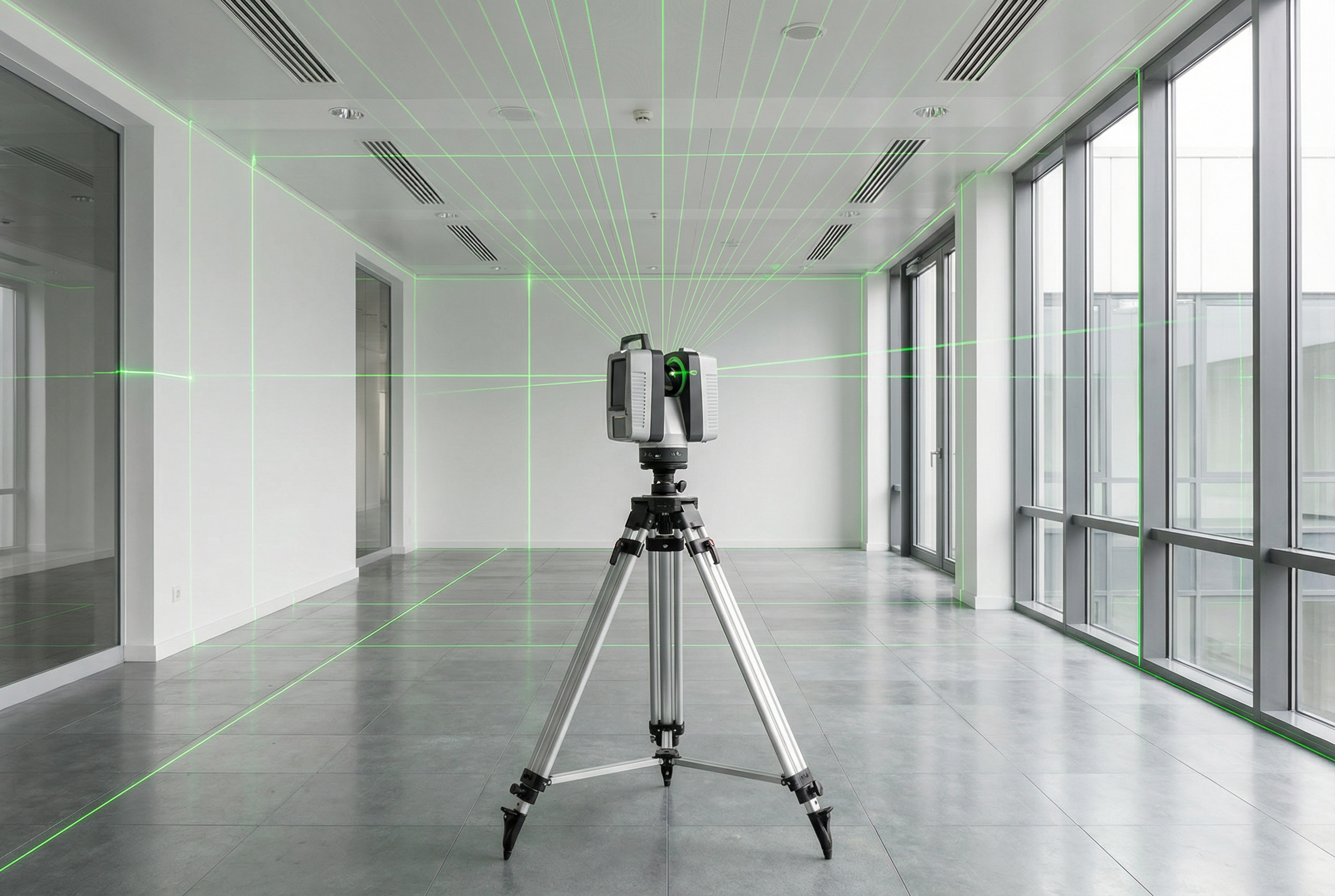
Laser scanning for buildings is a measurement technology that fires rapid laser pulses — 100,000 to 2,000,000 per second — at building surfaces, precisely timing each reflection to calculate distance. The scanner rotates 360 degrees, recording millions of 3D coordinate points that form a Point Cloud: a comprehensive digital measurement of the building's geometry.
For facility managers, architects, and property owners, this technology replaces weeks of manual measuring with days of precise, complete data capture — without disrupting building occupants or requiring any special safety precautions.
How Laser Scanning for Buildings Works
Laser scanning for buildings explained simply: the scanner sits on a tripod in the middle of a room and spins a full 360 degrees, firing laser pulses in every direction simultaneously. Each pulse travels outward, strikes a surface — wall, ceiling, column, pipe — and bounces straight back to the scanner.
The instrument records exactly how long that round trip took. Since light travels at a known speed, the scanner calculates the precise distance to every surface it "sees." Do this 2,000,000 times per second across a full rotation, and within minutes you have millions of individually measured 3D coordinate points covering every visible surface in the room.
That collection of points is the Point Cloud — the raw data asset from which all usable deliverables are created. Think of it as a 3D connect-the-dots with millions of measured points: individually they are just coordinates, but collectively they form a complete, measurable picture of the space. The Point Cloud is the foundation for scan-to-BIM services, which convert those measurements into BIM models, 2D floor plans, and as-built documentation.
The Time-of-Flight Measurement Principle
The physics behind laser scanning is called Time-of-Flight measurement. The principle is identical to how radar works — except radar uses radio waves, and laser scanning uses light.
A simple analogy: imagine shouting into a canyon and timing how long the echo takes to return. The longer the delay, the farther the canyon wall. Laser scanning works the same way, except instead of sound bouncing back once, it's light pulses bouncing back 2,000,000 times per second with millimeter-level precision.
This is fundamentally different from photography. A photograph captures appearance — color, texture, shadows. Time-of-Flight measurement captures geometry — exact distances, heights, angles, and spatial relationships. Two walls that look parallel in a photograph may actually diverge by 30mm. Laser scanning will detect that. A camera will not.
You may encounter the term LiDAR (Light Detection and Ranging) in discussions of this technology. LiDAR is one type of laser scanning — the same Time-of-Flight principle applied to vehicles, aircraft, and building documentation. When someone refers to LiDAR scanning for buildings, they mean the same measurement process described here.
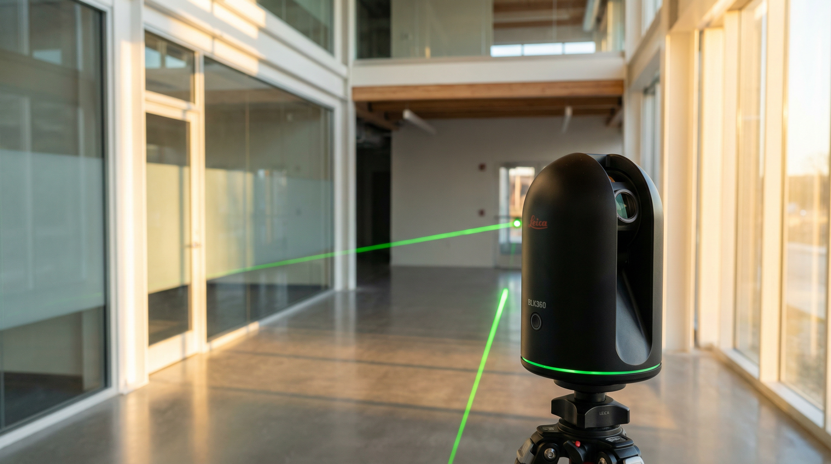
What Laser Scanners Look Like
A professional building laser scanner looks nothing like the industrial laser equipment the name might suggest. It is a compact, portable instrument roughly the size and shape of a large coffee maker — typically 10–15 inches tall — mounted on a standard camera tripod.
The technician carries the scanner and tripod from room to room, setting up in each location for a few minutes before moving on. There are no cables running across the floor, no large machinery, and no physical contact with building surfaces. The scanner simply sits in position, rotates, captures its data, and moves to the next location.
Each setup location is called a scan position. A complete building survey requires multiple scan positions — typically 10 to 50 or more — to ensure every surface is captured from multiple angles with no gaps. Think of it like taking a panoramic photograph from several spots in each room so no corner is missed. The data from all scan positions is later combined digitally through a process called point cloud registration, which stitches all the individual captures into one unified, accurate dataset.
Scanning Timeline and Equipment Accuracy
How long does laser scanning a building take? For a typical commercial office building in the 20,000–100,000 square foot range, field capture takes 2–3 days. Smaller buildings of 5,000–10,000 square feet may be completed in a single day. Large or complex facilities with restricted access may require more time.
After field capture, the point cloud data requires processing before it can be used. Professional scan-to-BIM services typically convert raw Point Cloud data into deliverables — BIM models, 2D CAD floor plans, or virtual walkthroughs — within 10–14 days from field capture completion.
Accuracy depends on the equipment tier used:
| Equipment Tier | Example Model | Speed | Accuracy |
|---|---|---|---|
| Survey-grade | LEICA RTC 360 | 2,000,000 pts/sec | ±2mm |
| Professional-grade | LEICA BLK 360 | 360,000 pts/sec | ±6mm |
| Consumer-grade | MATTERPORT Pro3 | 100,000 pts/sec | ±20mm |
For a renovation project, ±2–4mm accuracy means an architect can confidently design new elements knowing the existing conditions measurements are exact. At ±20mm, broader spatial planning is possible but precise fit-out design carries more risk.
Laser Scanning Safety: What Building Occupants Should Know
A common concern for facility managers considering laser scanning in occupied buildings: is the laser safe?
Building laser scanners use Class 1 eye-safe lasers — the same safety classification as supermarket barcode scanners and DVD players, as defined by the IEC 60825-1 international laser safety standard. The lasers produce no radiation, no harmful emissions, and no heat. Building occupants require no protective equipment, no safety briefings, and no evacuation.
The scanning process is completely silent and visually unobtrusive. Most building occupants continue their normal activities without noticing the scanner operating nearby. For facility managers, this means laser scanning can typically be scheduled during normal business hours without disrupting operations — a significant practical advantage over traditional survey methods that may require after-hours access.
Building Applications and Value Compared to Traditional Methods
3D scanning for buildings is used across a wide range of building documentation needs:
- Renovation planning: Architects receive exact as-built conditions before design begins, eliminating field measurement errors that cause costly change orders during construction
- Facility management baselines: A complete Point Cloud creates a permanent spatial record of the building — useful for tracking changes, planning maintenance, and managing space
- MEP documentation: Mechanical, Electrical, and Plumbing systems can be fully mapped, including pipe diameters, routing paths, and clearances
- Construction verification: Comparing laser scan data to design drawings confirms whether completed work matches specifications within tolerance
Traditional documentation methods — tape measures, laser distance meters, manual sketching — require surveyors to physically measure every dimension and typically take two to three weeks for a medium-sized commercial building. The results are only as accurate as the individual measurements taken, and any missed dimension requires a return site visit.
Laser scanning captures every surface simultaneously in a single field operation. The resulting Point Cloud contains more measurements than any manual survey could practically achieve, at higher accuracy, in a fraction of the time.
Key Takeaways
Laser scanning for buildings uses Time-of-Flight measurement — the same physics as radar, applied using light — to record millions of precise 3D coordinate points across every surface in a building. Those points form a Point Cloud: the raw data asset from which BIM models, 2D floor plans, and as-built documentation are created.
The technology is safe for occupied buildings, uses compact portable equipment, and typically completes field capture in 2–3 days for commercial buildings. Equipment accuracy ranges from ±2mm at the survey-grade tier to ±20mm at the consumer grade, with the appropriate tier depending on the precision requirements of the intended deliverables.
For building owners and facility managers, laser scanning replaces weeks of manual measurement with days of comprehensive, accurate data — providing a reliable foundation for renovation design, facility management, and construction verification.