Robotic ImagingApril 11, 2023
We know that 3D scanning and scanning-to-BIM services can be used to improve safety and optimize infrastructure in cities across the United States. But how? In this article, we will show you how 3D scanning technology works, what benefits it provides for road safety, and how Scan-to-BIM improves project efficiency. Then we’ll take a look at how these technologies are already being used by city governments across America. We want to help you better understand why this technology is so important for public works projects across America today.
How Can LiDAR and Scan-to-BIM Services Improve Road Safety and Help Optimize Infrastructure in Cities Across the United States?
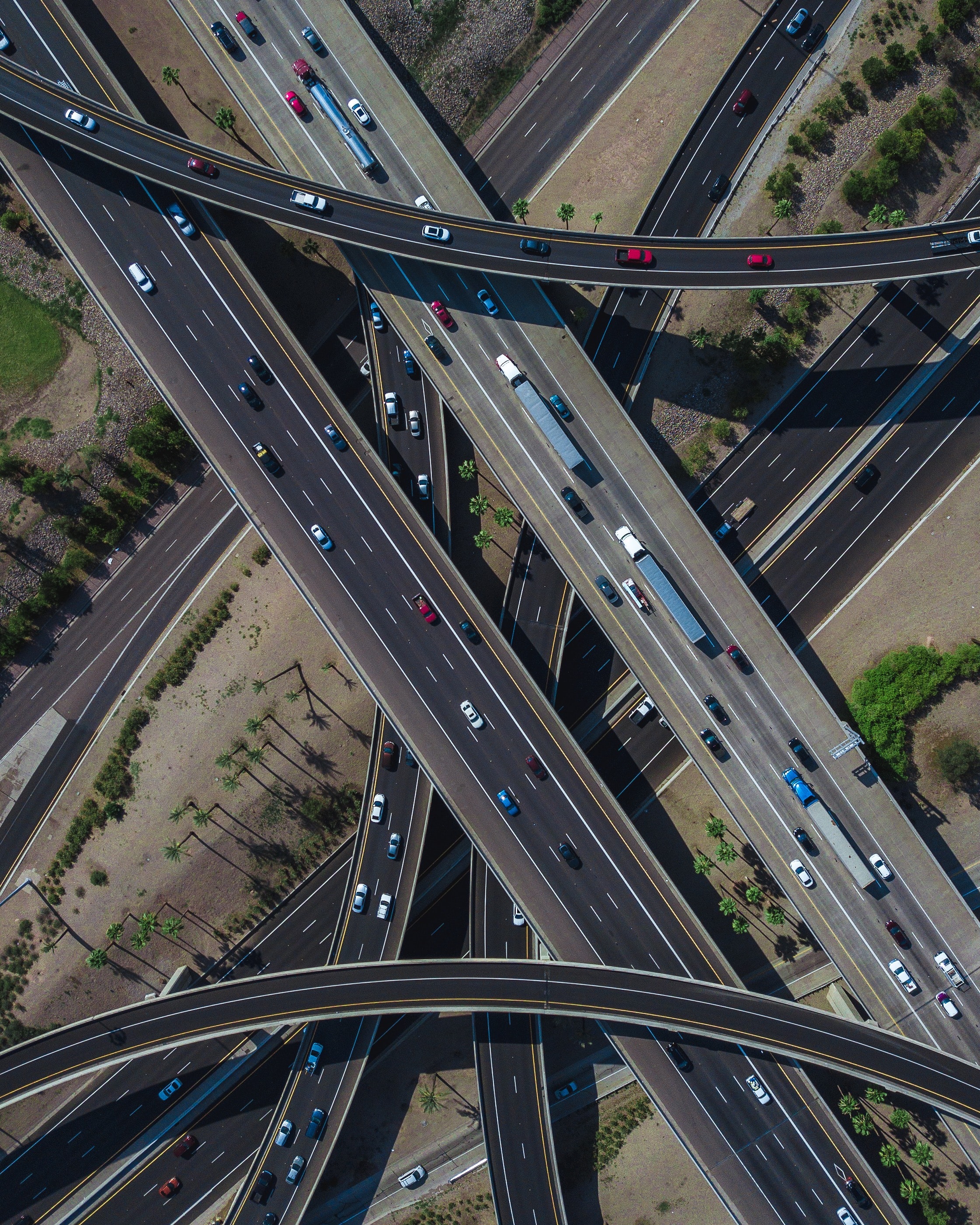
LiDAR (Light Detection And Ranging) is a remote sensing technology that uses pulsed laser light to measure distances. It operates much like sonar, except that LiDAR uses infrared lasers rather than sound waves. When combined with other technologies such as aerial photography and high resolution photography, it is possible to create highly accurate 3D models of entire cities or even neighborhoods within them. These 3D models allow planners to make informed decisions about where roads should go before they are built so they don't interfere with underground utilities or natural features such as rivers or lakes; they also allow engineers to optimize traffic patterns at intersections by adjusting signal timing based on real-time traffic flow data generated by vehicle sensors placed along major thoroughfares throughout town.
How Does 3D Scanning Work?
LiDAR is a remote sensing technology that uses light pulses to measure distance. LiDAR can be used for 3D scanning and mapping, which is how it helps create roadways that are safer for drivers, pedestrians and cyclists. LiDAR scanning is done by sending out laser beams from an aerial survey aircraft or drone and then measuring the time it takes for those pulses to bounce back towards the source. This information is used to create a highly accurate 3D model of your environment in real time, allowing you to see things like structural defects or weak points in bridges before they become problems later on down the line.
What Are the Benefits of Scan-to-BIM Technology?
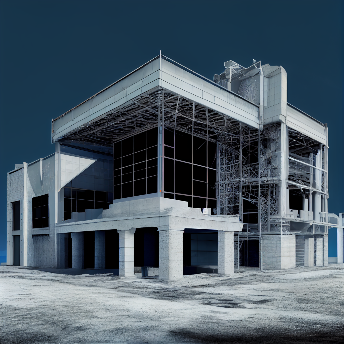
Scan-to-BIM technology is a method of creating 3D models from 2D images. The process involves scanning the object or environment using LiDAR, which then creates a point cloud that can be used to create a 3D model in software such as Autodesk Revit. This allows for faster and more accurate BIM models than traditional methods like photogrammetry or manual tracing.
What Does LiDAR Do for Road Safety?
LiDAR can be used to scan the terrain and create a 3D model of the environment (including buildings) or measure distances between objects in three dimensions. Nowadays, LiDAR systems are commonly used by autonomous vehicles for object detection and obstacle avoidance, as well as navigation purposes by measuring data points from surrounding objects like trees or buildings. LiDAR has also been used by researchers at Virginia Tech University who developed an open source application called OpenRoadsMap (ORM). ORM provides free access to high-resolution digital maps based on LiDAR data collected across America's roadways- a critical resource when planning infrastructure projects such as new highway construction or expansion projects; bridge repairs; etc.
With increased use of 3D scanning, cities will be able to more quickly optimize their infrastructure to improve traffic flow and road safety. When it comes to road safety, LiDAR and 3D scanning can be a great asset. The technology is already being used in many cities across the United States to scan roads and infrastructure with incredible accuracy. This allows project managers to quickly identify problem areas and make adjustments before they become costly issues down the line.
For example, if you want to optimize your infrastructure for better traffic flow or reduce pedestrian-related accidents on a particular street, using this technology will allow you to see how much space there is between cars as well as how much room there is between road signs--information that might not be obvious from looking at just one side of things during construction or repair work.
How Does Scan-to-BIM Help Save Time for Project Managers?
Scan-to-BIM technology helps project managers and engineers to visualize their projects before they are built. This allows them to make changes to the design of the project before construction begins, saving time and money.
With the growing use of LIDAR and Scan-to-BIM technology, cities will be able to more quickly optimize their infrastructure to improve traffic flow and road safety. This is an exciting time for cities across America as they look towards the future of transportation and urban planning.