BaseFree Pay-As-You-Go
Get the App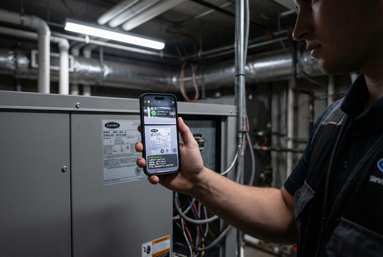
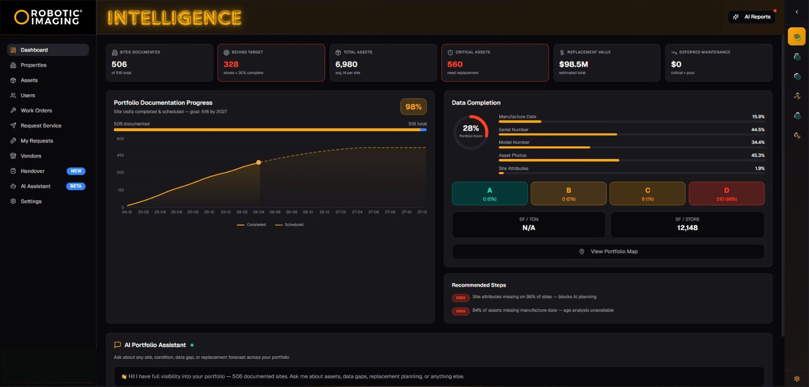
RI Mobile & Web App
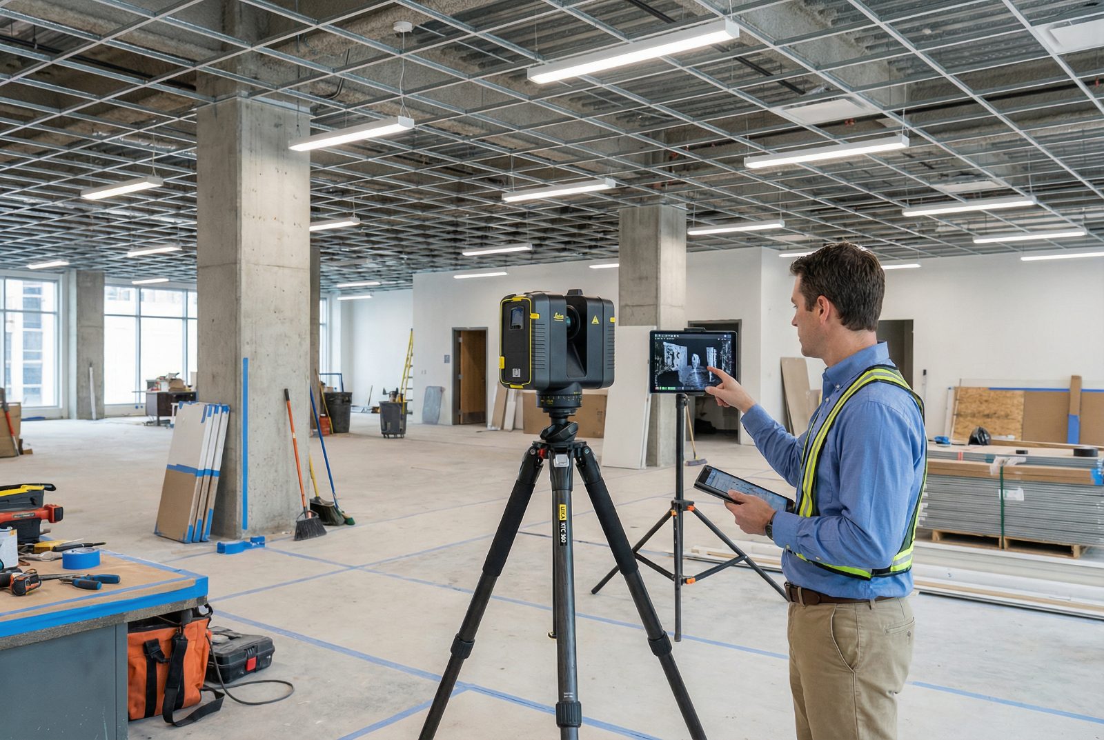
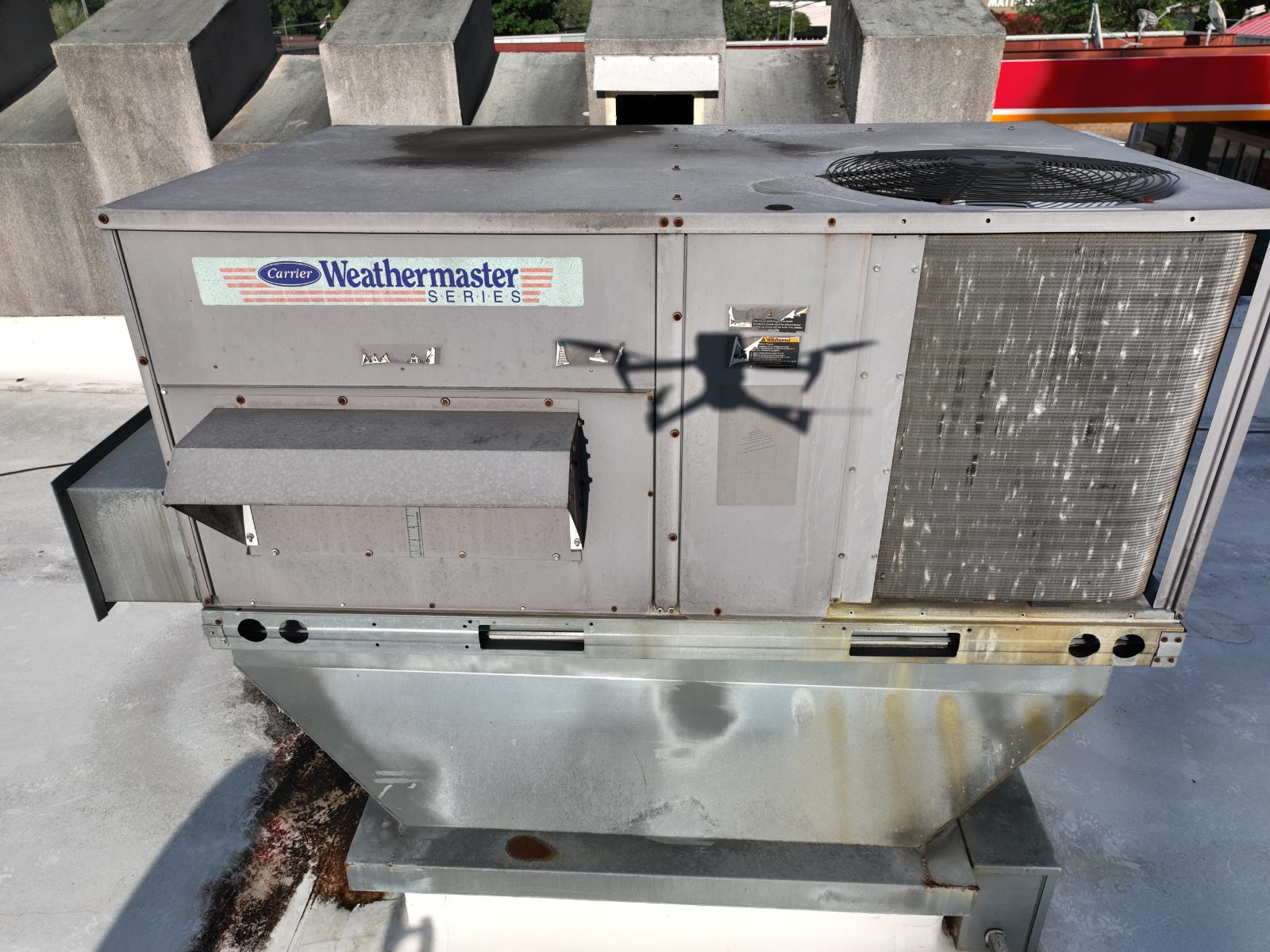
Field Data RequiredConstruction's new field tool. Capture, tag, document — from your phone.
iOSAndroidOfflineQR + OCRFacilities Mgmt
Construction's new field tool. Capture, tag, document — from your phone.
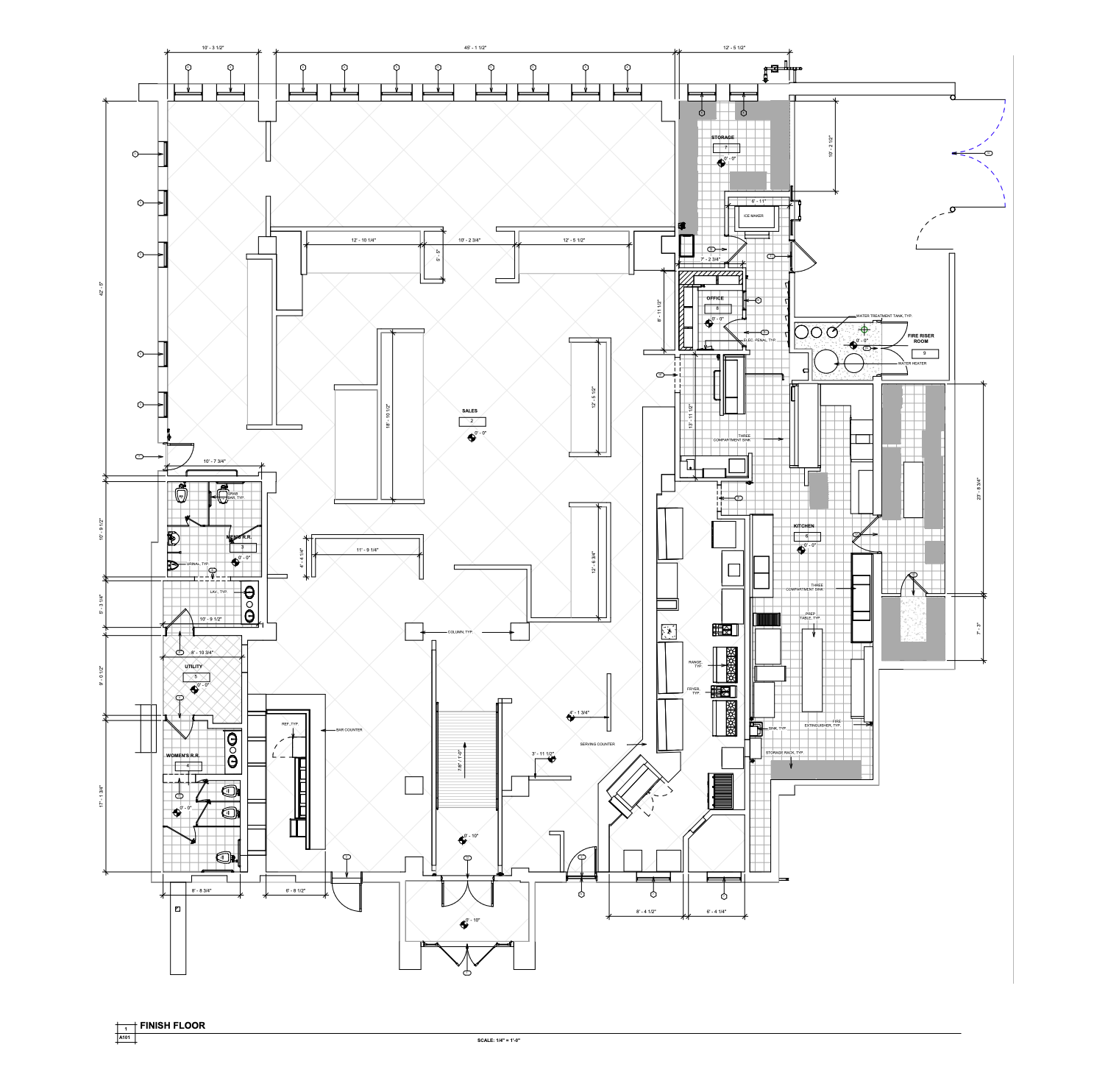
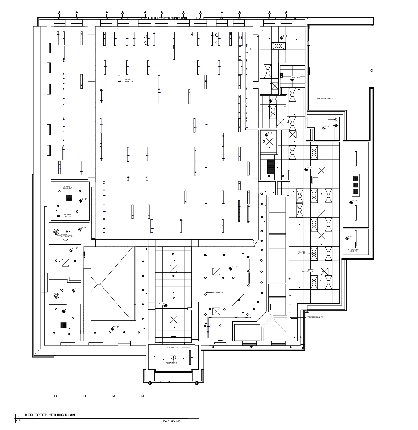
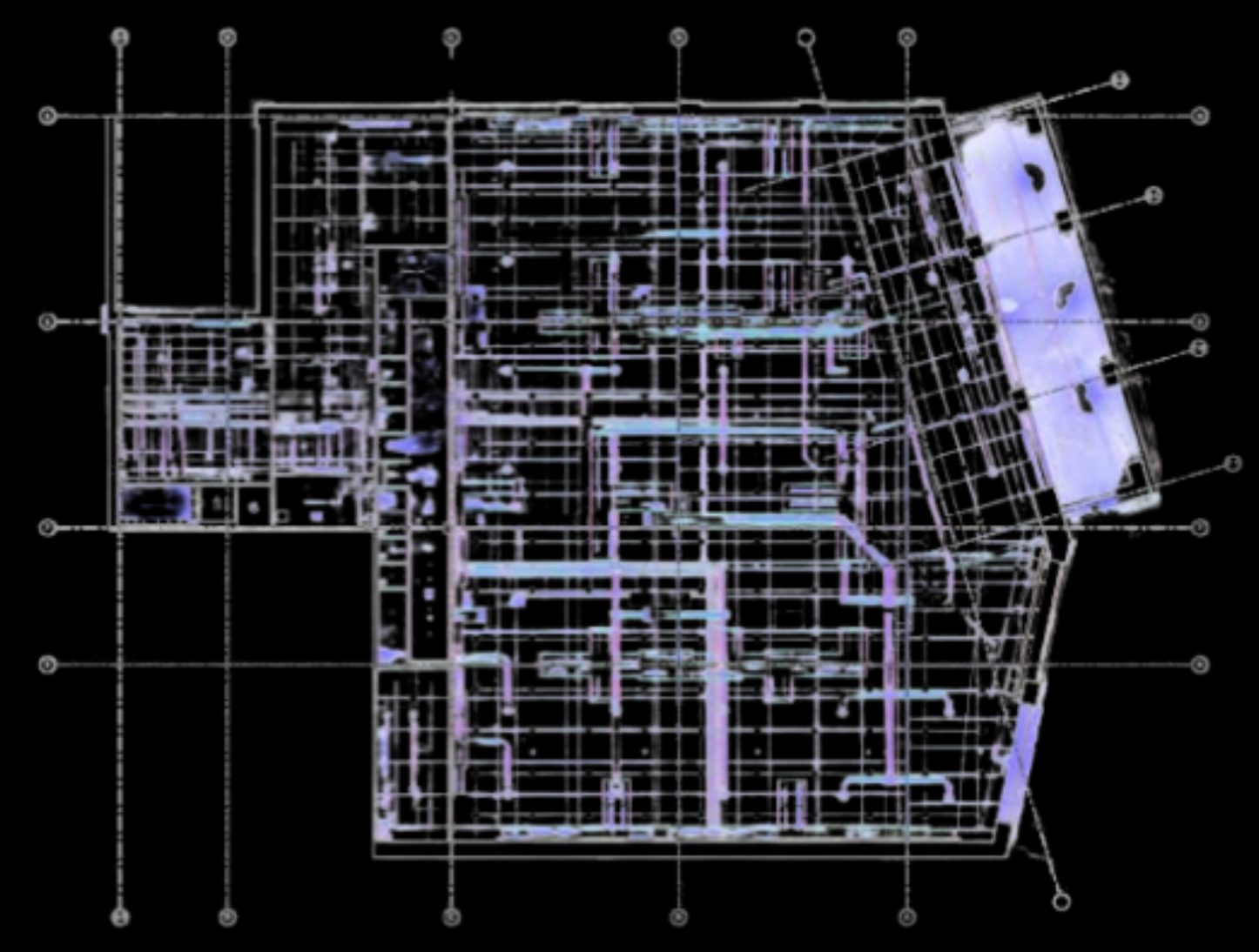
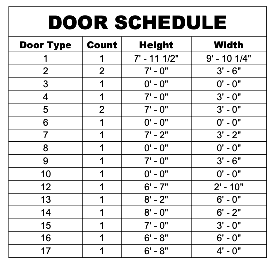
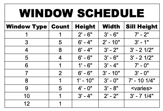
As-built 2D drawings — plans, RCPs, elevations — delivered native with layers, blocks and title sheets.
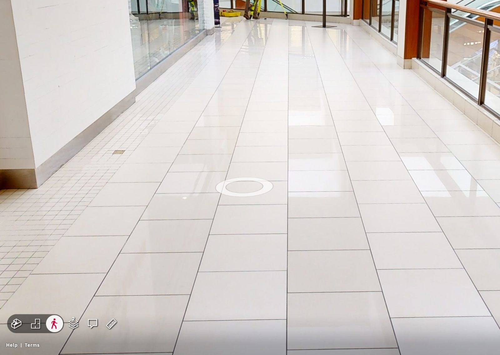
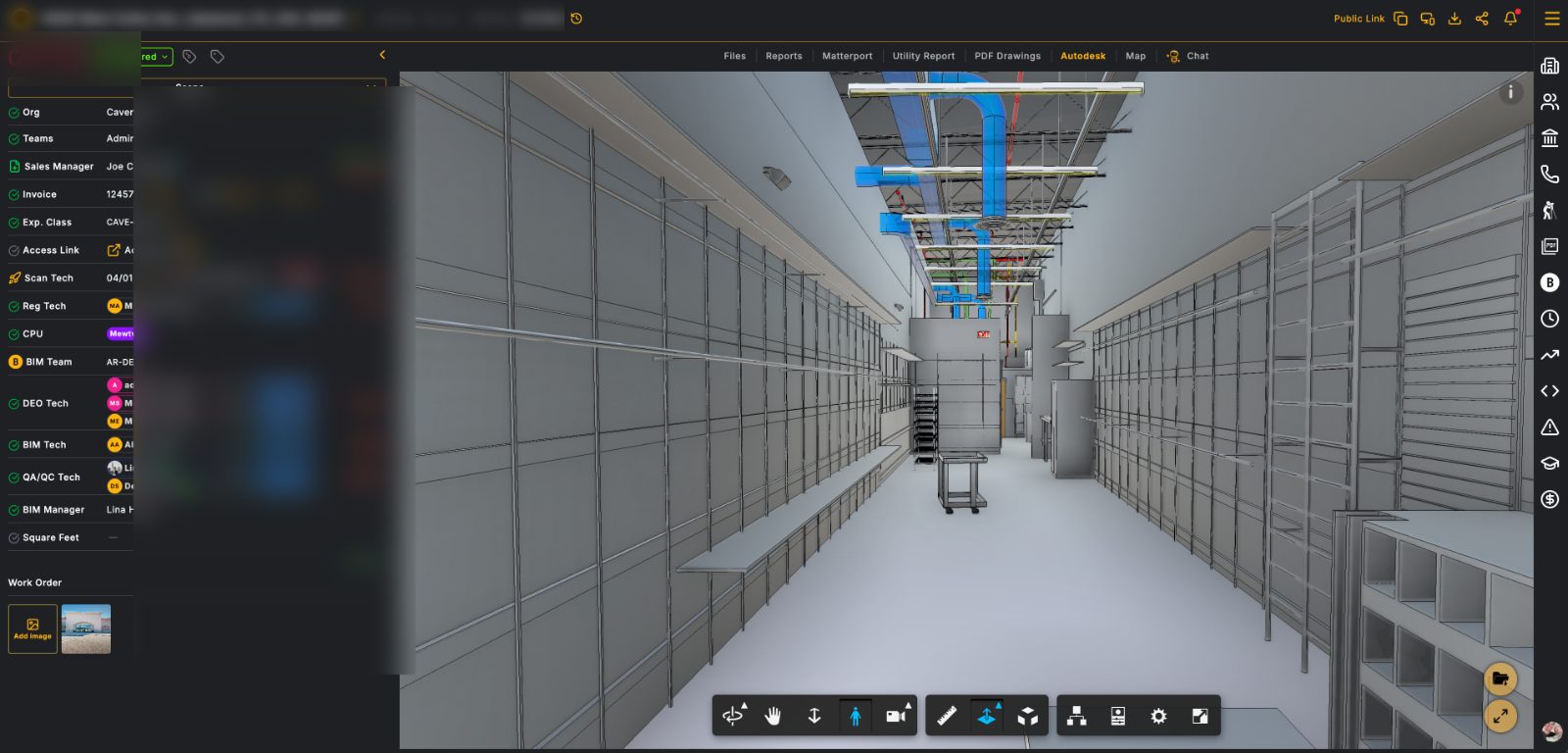
3D/VR self-directed web-links with archiving.
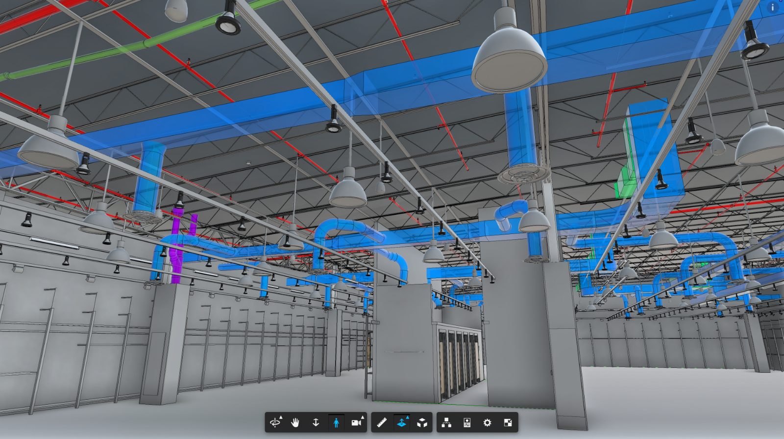
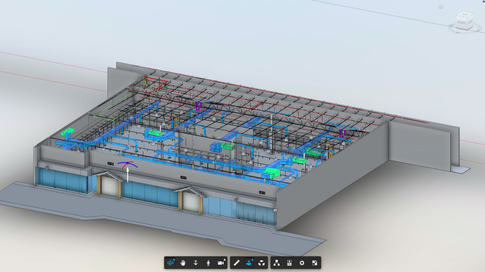
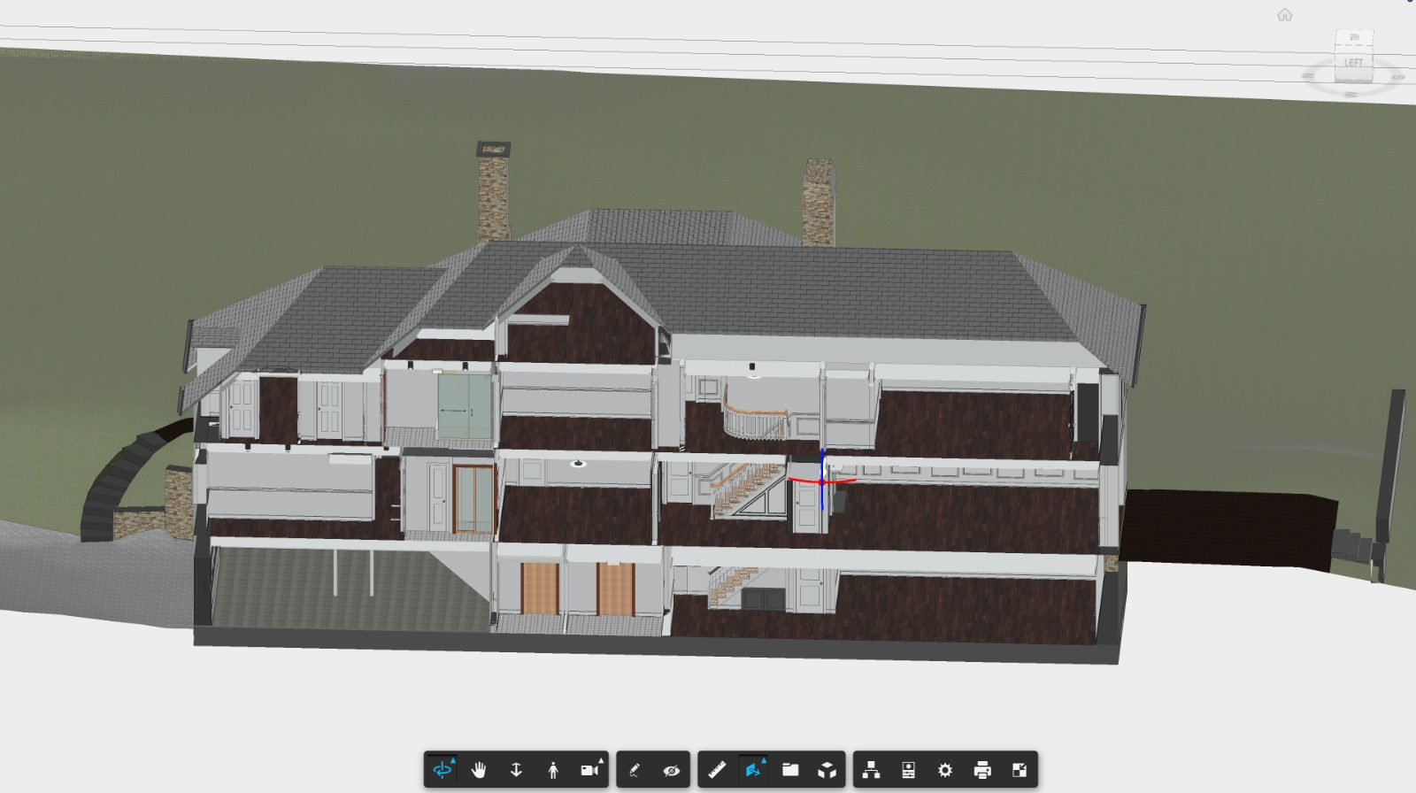
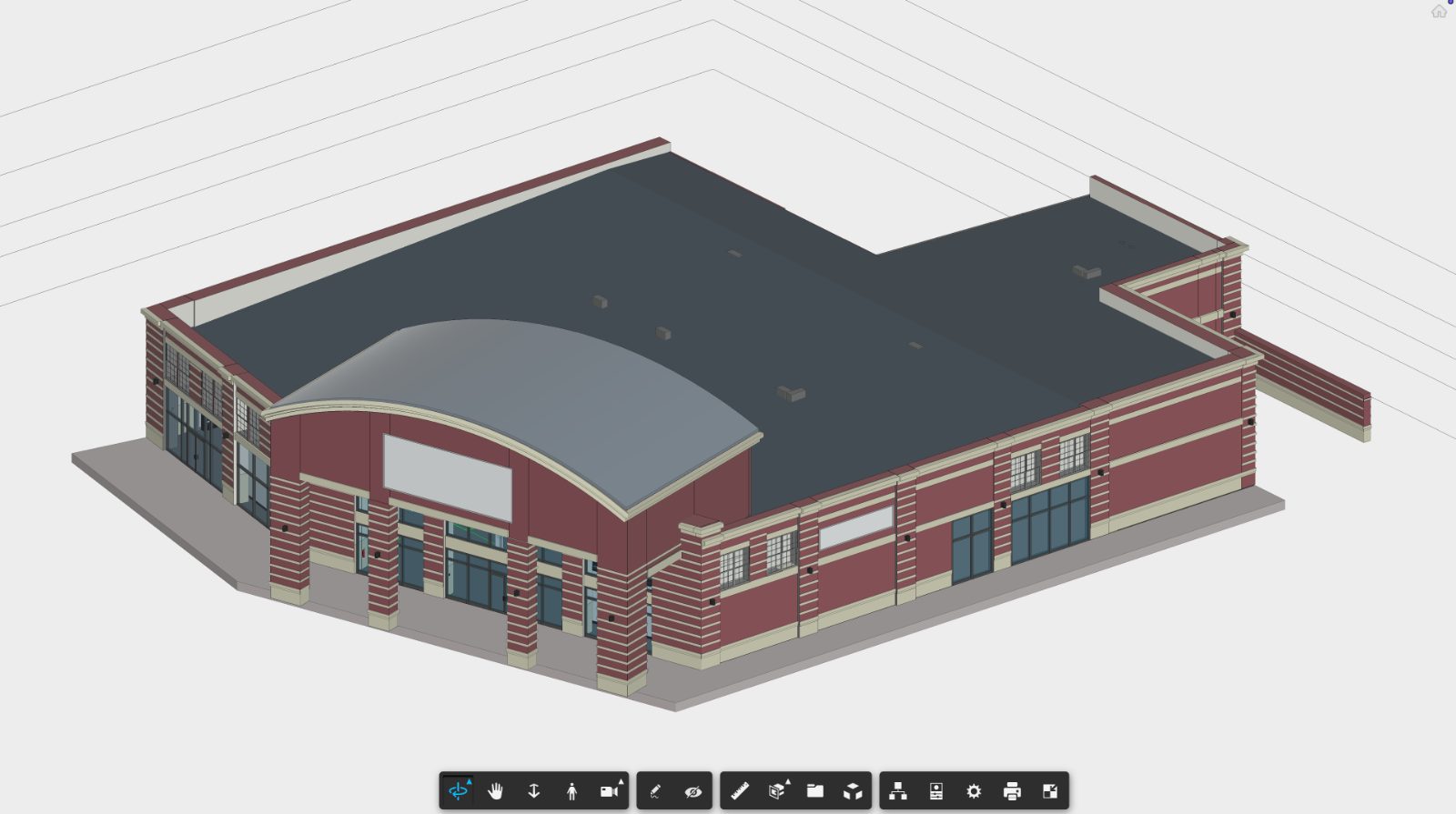
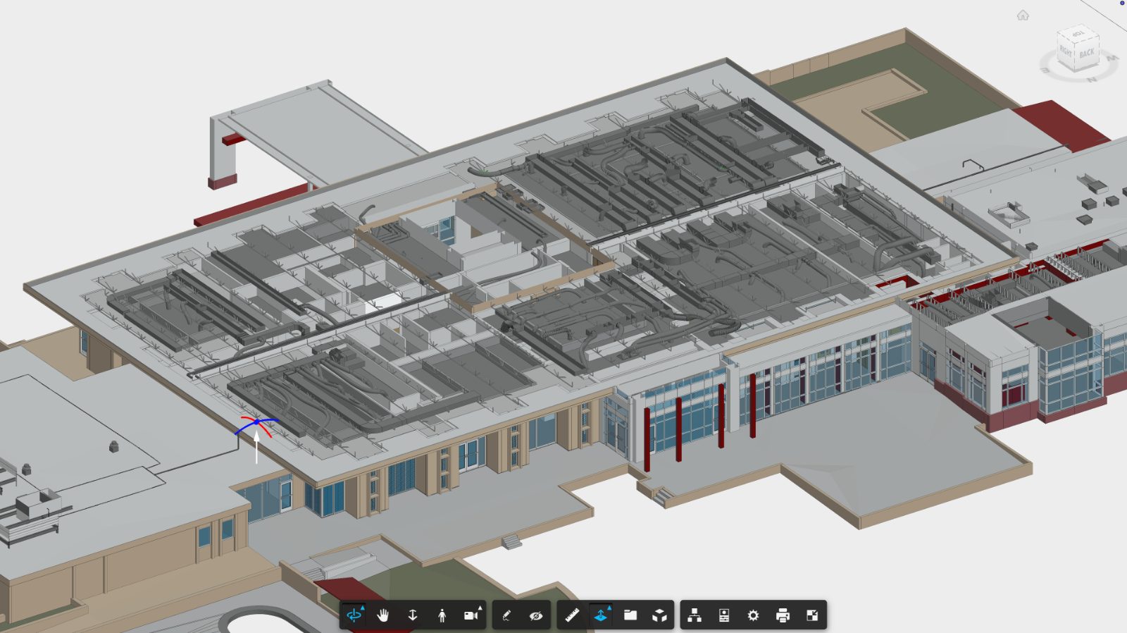
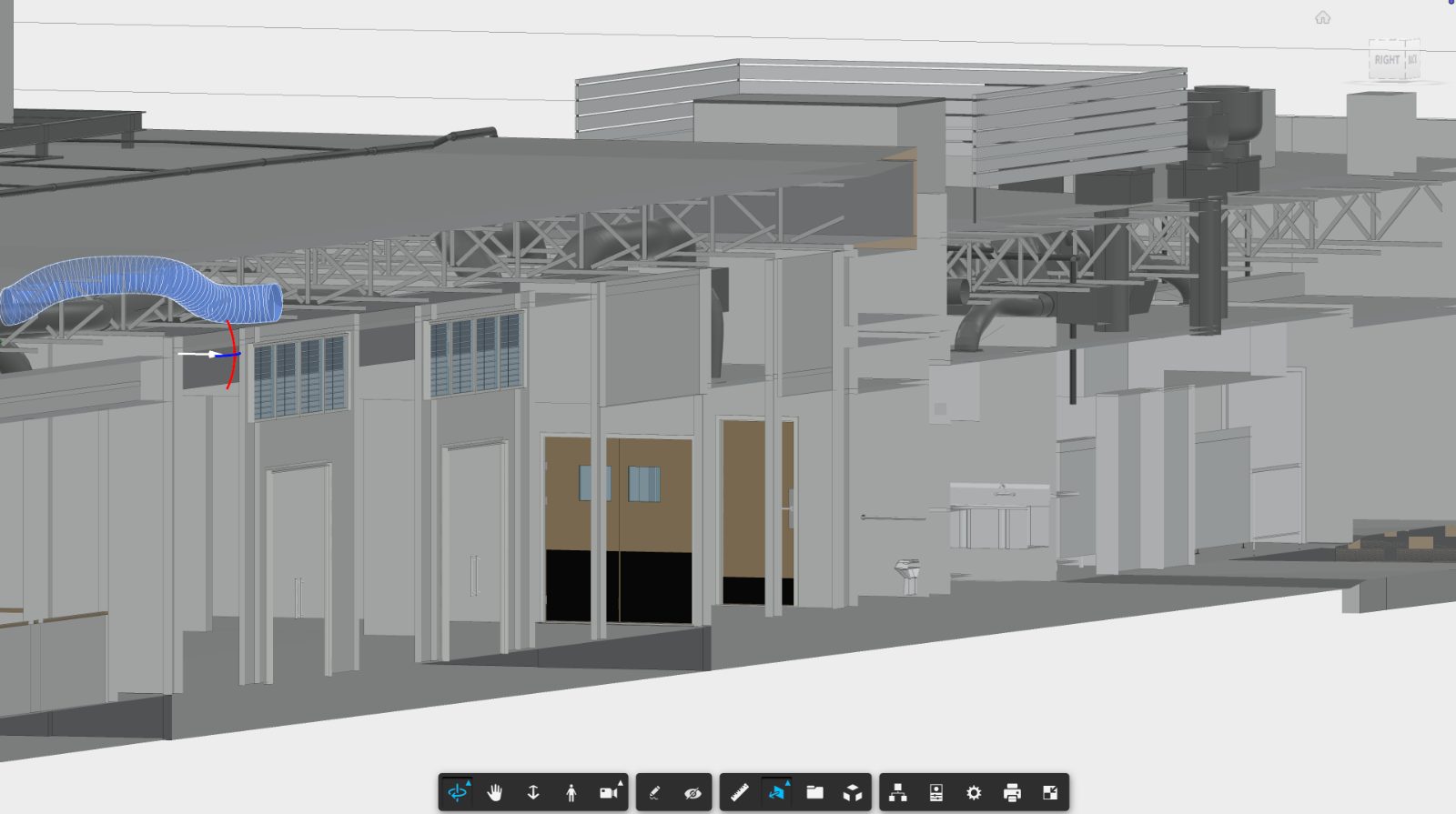
3D existing conditions BIM models to accelerate building and digital transformation.
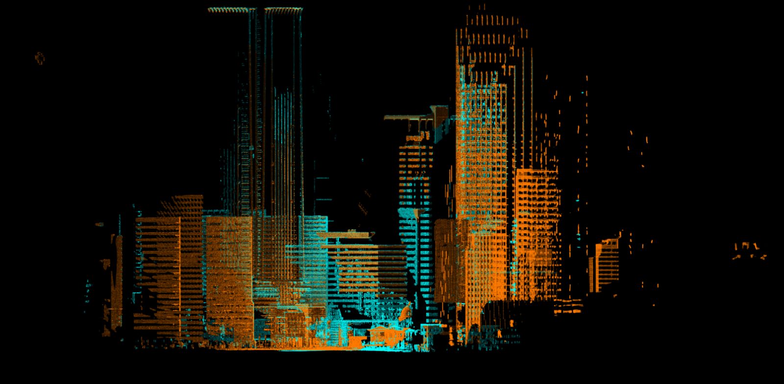
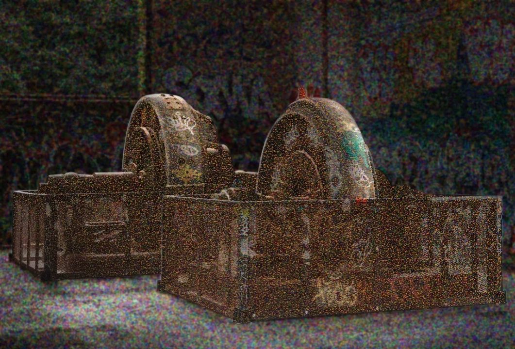
Sub-centimeter point cloud of the full site. Registered, colorized, delivered ready for downstream design.
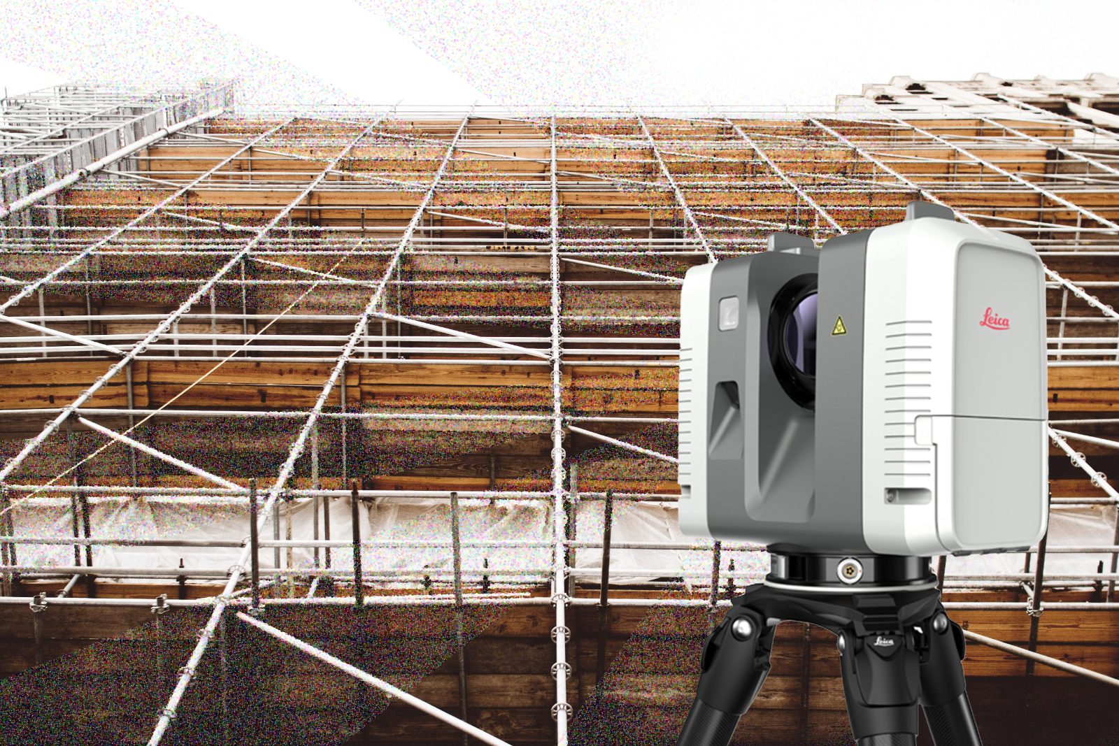
Standard aerial roof & site documentation — orthomosaic, 3D photogrammetry mesh, raw photo archive and utility overlays.
Hand-drafted architectural sheets — plans, sections, elevations and details — from scan data or existing drawings.
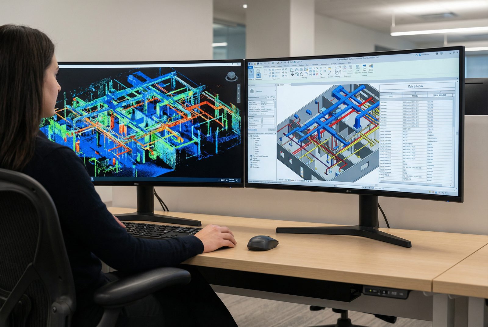
3D production and BIM management custom to your workflow.