How Using LiDAR Drone Surveying Can Optimize Workflows
Robotic ImagingJanuary 13, 2023
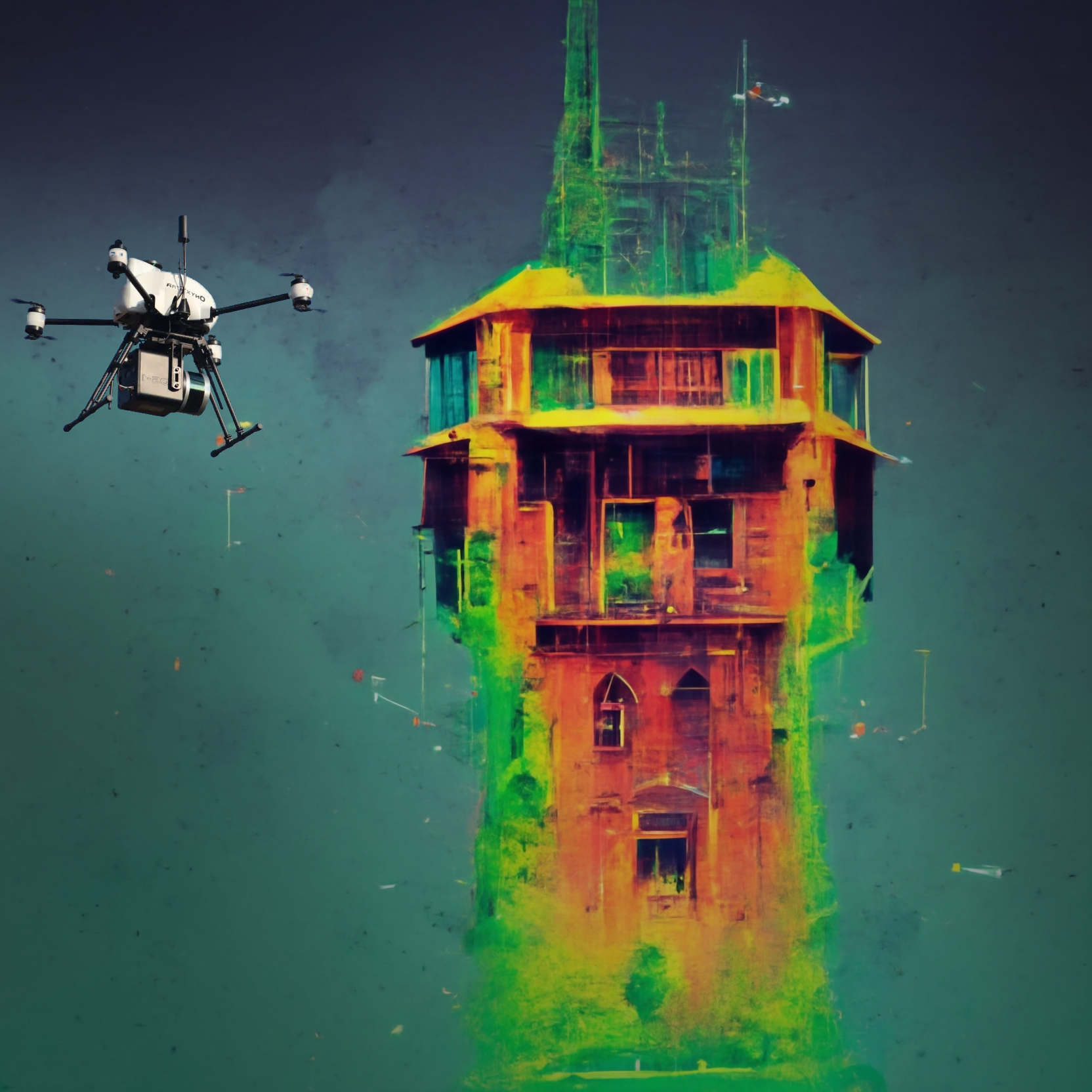
LiDAR drone surveying is a fast, efficient way to produce 3D point clouds. It enables you to gather critical data while reducing your risk of injury and making site inspections safer than ever before. So what are you waiting for? Dive deeper into this technology here!
Get a Bird’s-Eye View of Your Project
LiDAR is a powerful technology that can help you better understand your project. It works by transmitting pulses of light from a laser and measuring how long it takes for the light to bounce back. The more data points collected, the more accurate your measurements will be.
LiDAR is used in both construction and infrastructure projects as well as mining, forestry and agriculture (to name a few). In addition to being able to collect information about terrain features like hills or valleys it also allows you to see through objects such as trees or buildings so that they don't obscure what's going on below them.
Suggested reading: If you want to learn more about LiDAR scanning workflows, check out this article.
Increase the Speed and Accuracy of Your Projects
LiDAR drone surveying has the ability to increase the speed and accuracy of your projects. Using LiDAR, you can survey large areas quickly, which means that you don’t have to wait for days or weeks before seeing results from your drone surveys. You can also get accurate measurements in difficult to reach areas where traditional methods would require extensive transit time.
Additionally, high density objects like buildings will be easier to detect with LiDAR than if they were just identified by eye alone. This means you can make decisions based on data rather than guessing!
Finally, when using LiDAR drones for surveying purposes it’s important that they are properly calibrated so their readings match up exactly with what we expect them too; otherwise we might end up getting inaccurate information about our surroundings (and this could lead into disasters).
Get a Detailed Picture of Your Site
The LiDAR drone survey is a powerful tool for improving site planning, but it's not just about getting a detailed picture of your site. It can also be used to measure distances from one point on the ground to another point on the ground and from one point in space (e.g., an object) to another point in space (e.g., another object).
For example, if you need to know how far away something is so that you can build it accurately and precisely, then laser distance measurement will help get this done quickly and accurately—without having to measure each individual item individually with tape measures or other devices such as rulers or pens!
Safely Access Near-impossible to Reach Sites
LiDAR drones are able to safely access areas that are difficult to get to. They can collect data in areas where it is dangerous for people to go, or where crews would otherwise have difficulty accessing. For example, if you need a topographic survey of an inaccessible mountain peak, using LiDAR drone technology will allow you to safely reach the site and collect valuable data.
Communicate More Effectively With 3D Point Clouds
With 3D point clouds, you can create a variety of visualizations and models. You may want to visualize the topography of your area or use them as reference points for other datasets.
For example, if you are mapping an area with LiDAR technology, this data can be used as an overlay with other datasets (such as satellite images) to create a 3D model of your entire surrounding environment. This will allow you to see what’s going on in different parts of your property at once!
Improve Safety Audits and Inspections
On site, you can significantly improve safety audits by reducing the need for people to enter dangerous areas, while still gathering crucial data.
Safety audits and inspections are an important part of any construction project. They help ensure that people are safe on site and this can include checking for any issues with the site or equipment, as well as ensuring that precautions have been taken to prevent accidents from occurring.
One way LiDAR technology is being used to improve safety audits is by allowing surveyors to gather data at high resolutions in difficult-to-reach areas where traditional surveying methods may not be possible. This means that when working in dangerous areas such as subways or enclosed spaces, you can use your drone instead of human workers who could be injured by falling debris or getting caught up in equipment malfunctioning due to poor maintenance practices (such as electrical faults).
With LiDAR technology being so accurate at capturing fine details like cracks on walls or uneven surfaces beneath them (which would otherwise go unnoticed), it also has applications within industry standards like ISO 9001:2015 - Quality Management Systems Requirements Version 2 (QMSRV2) which requires companies providing products such as medical devices do not compromise quality by cutting corners during installation procedures."
Produce 2D Maps and 3D Models Quickly and Accurately in a Single Flight
LiDAR is a type of laser scanning that uses light in the form of a pulsed laser to measure distances. It's often used for 3D modeling and can produce accurate outputs by taking hundreds of readings from different angles and distances, which results in more accurate data than traditional surveying methods.
LiDAR drones are equipped with powerful cameras that capture high-resolution images of real-world objects or structures (such as buildings) using infrared light beams. The resulting digital models can be easily manipulated into 2D or 3D formats without requiring any additional software or hardware.
A Deeper Drive into LiDAR Drone Surveying
LiDAR (Light Detection and Ranging) is a technology that uses lasers to create three-dimensional models of terrain. A LiDAR drone surveyor can use this data to create maps of buildings and other structures, so they can be inspected more easily when construction projects are underway.
LiDAR drones have been used in surveying projects for decades, but only recently have they become more affordable to homeowners who need accurate measurements on their property without having access to heavy equipment such as excavators or graders—which would cost thousands of dollars per day just for use during construction season!
Conclusion
LiDAR drone surveying is a great way to get the data you need for your project quickly and accurately. By getting a bird’s-eye view of the site before anyone even steps foot on it, you can make sure that no one gets hurt or injured by an unstable surface or other hazards. LiDAR drones have been used in many different industries over the past few years, including construction, forestry, agriculture and more! They are also an excellent tool for inspecting homes after they have been built so that everything can be inspected before moving forward with construction.