Leica P50 Industrial Scanning | 1km Range | Robotic Imaging
Robotic ImagingJuly 6, 2026
Leica P50 Industrial Scanning: Long-Range Point Cloud Capture for Large Plants
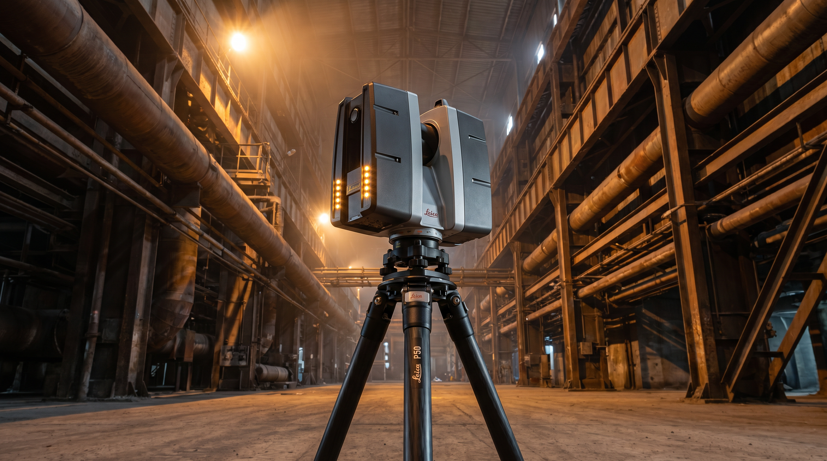
The LEICA P50 is a survey-grade terrestrial laser scanner with a 1km range and 1,000,000-point-per-second capture rate, purpose-built for large industrial facilities where standard scanners cannot safely reach critical infrastructure. In petrochemical plants, power generation facilities, and heavy manufacturing environments, its long-range capability eliminates scanner repositioning in hazardous or restricted-access zones.
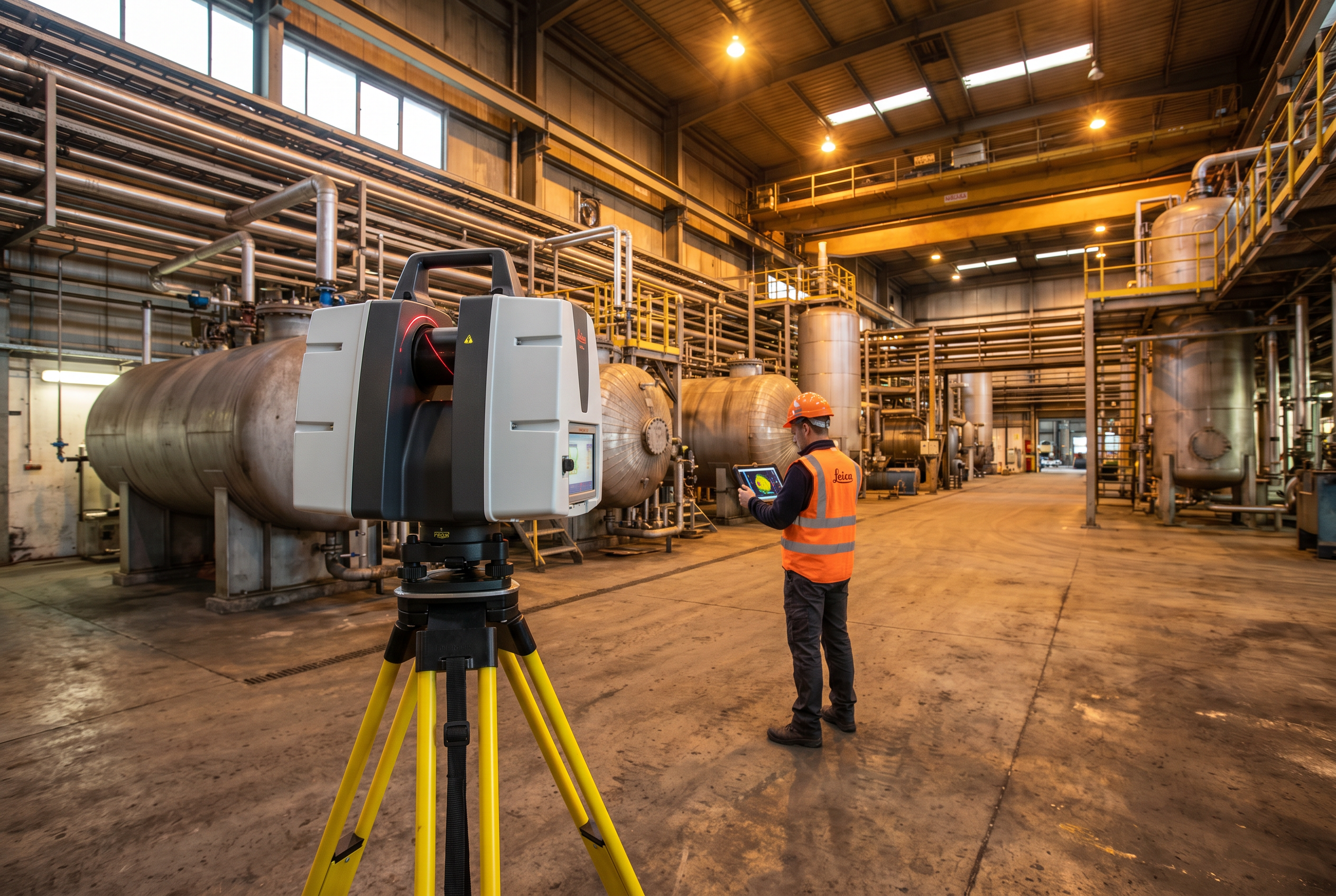
For capital project managers, plant engineers, and facility documentation teams operating at industrial scale, the LEICA P50 solves a problem that shorter-range scanners cannot: capturing accurate, high-density Point Cloud data from structures and assets that are physically inaccessible, elevated, or located within live process areas where repositioning a scanner every 15–20 metres would be operationally unsafe or logistically impossible. Robotic Imaging deploys the LEICA P50 as part of an active multi-scanner fleet — alongside the LEICA RTC 360 and LEICA BLK2GO — to deliver engineering-grade 3D documentation for industrial facilities, from brownfield retrofits and pre-FEED studies to scheduled plant turnarounds and asset lifecycle documentation programmes.
What Is the LEICA P50 and Why Does Industrial Scanning Demand Long Range?
Terrestrial laser scanning (TLS) works by emitting millions of laser pulses per second from a fixed tripod position, measuring the precise distance and angle to every surface the laser strikes, and building a three-dimensional Point Cloud from those measurements. The critical variable in industrial environments is range — how far from the scanner a surface can be and still return usable data.
Most commercial-grade scanners are designed for architectural interiors: offices, hospitals, retail stores, warehouses with standard ceiling heights. At those scales, a 40–130m range is adequate. An industrial plant is a fundamentally different geometry. A crude distillation unit may stand 60m tall. A power generation turbine hall may span 200m in length. Process piping runs at height across open bays, connecting vessels that are physically unreachable without scaffolding or elevated work platforms. Scanning those assets from ground level with a short-range instrument requires dozens of additional scan stations — each representing lost time, increased registration error accumulation, and added exposure risk for field personnel.
The LEICA P50's 1km range resolves this constraint directly. A single scan station can capture structural steel, vessel exteriors, overhead pipe racks, and ground-level process equipment in a single setup, from a safe standoff distance outside restricted or hazardous zones. Combined with survey-grade accuracy, the P50 produces Point Cloud data that engineering teams can use for as-built documentation, clash detection, and Scan-to-BIM modelling — without the geometric gaps or registration inconsistencies that result from under-equipped scanning programmes.
For capital project managers evaluating scanning vendors before a FEED study or scheduled turnaround, the scanner in the vendor's fleet is a direct proxy for the quality and completeness of data they will receive. Robotic Imaging's deployment of the LEICA P50 alongside complementary instruments is a measurable capability distinction in this market.
Industrial Environments Where LEICA P50 Scanning Delivers Maximum Value
Not every industrial facility demands 1km-range scanning. The LEICA P50's deployment is most justified — and its commercial value most significant — in four distinct facility categories where geometry, scale, or access constraints exceed what shorter-range instruments can address.
Petrochemical plants and refineries present the most demanding scanning environment in the industrial sector. Tall vertical structures, elevated pipe racks, heat exchangers, storage vessels, and flare stacks are distributed across large horizontal footprints, with many assets in hazardous area zones (ATEX-classified or equivalent) where personnel time is strictly limited. The LEICA P50 captures these assets from safe perimeter positions, reducing exposure time and eliminating the need for scaffolding access during non-shutdown periods. Industrial clients in this category — including facilities of the type serviced by Robotic Imaging's verified industrial programme clients Metalwërks and Puratos Inc. — demand complete structural and process documentation for retrofit design and capital project engineering.
Power generation facilities — including thermal, combined cycle, and renewable generation sites — combine large structural spans with dense mechanical installations. Turbine halls, cooling tower structures, and switchyard infrastructure involve both long-range structural elements and high-density mechanical assemblies. A multi-scanner approach using the LEICA P50 for structural span capture and the LEICA RTC 360 for precision mechanical documentation delivers complete coverage without compromise.
Heavy manufacturing facilities — including automotive assembly plants, steel mills, and food processing plants of the scale operated by clients such as The Plant — involve complex overhead crane systems, production line infrastructure, and floor-level process equipment that must be documented together as an integrated 3D model. The P50's capture rate of 1,000,000 points per second enables rapid field coverage without sacrificing Point Cloud density at distance.
Large-span distribution and logistics facilities with racking systems, mezzanine structures, and building envelopes exceeding standard scanner range also benefit from the P50's capability, particularly for combined structural and MEP documentation programmes where completeness of coverage matters more than any individual scan's resolution.
LEICA P50 Technical Specifications: What Does 1km Range Mean on a Plant Floor?
The LEICA P50 is a long-range terrestrial laser scanner manufactured by Leica Geosystems, confirmed by the manufacturer's primary product documentation. Its key operational specifications are:
| Specification | LEICA P50 | FARO Focus Premium | Trimble X9 |
|---|---|---|---|
| Maximum Range | 1,000m (1km) | 350m | ~80m |
| Capture Rate | 1,000,000 pts/sec | ~976,000 pts/sec | ~500,000 pts/sec |
| Accuracy | Survey-grade | ±2mm at 25m | ±1mm at 20m |
| Primary Use Case | Large industrial, long-range survey | Mid-range architectural/industrial | Short-range architectural |
In practical terms, the P50's 1km range means that a single scan station placed at the boundary of a large process unit can capture every visible surface within that unit — pipe racks, vessel shells, structural columns, platforms — in a single setup that takes minutes rather than hours. A scanning firm relying on a 350m-range instrument to document the same asset would need to place scanner stations at approximately three times the density to achieve equivalent coverage, multiplying field time, registration steps, and potential error propagation.
At 1,000,000 points per second, the LEICA P50 generates sufficient Point Cloud density even at long standoff distances to support engineering-grade as-built documentation. The resulting Point Cloud data is processed in Autodesk ReCap Pro and delivered in industry-standard formats — RCS, RCP, E57, and LAS — compatible with the full suite of plant engineering software platforms. Survey-grade accuracy from the P50 means capital project teams can trust the dimensional data for design, fabrication clearance checks, and regulatory documentation without independent verification surveys.
LEICA P50 vs LEICA RTC 360: Which Scanner Is Right for Your Industrial Project?
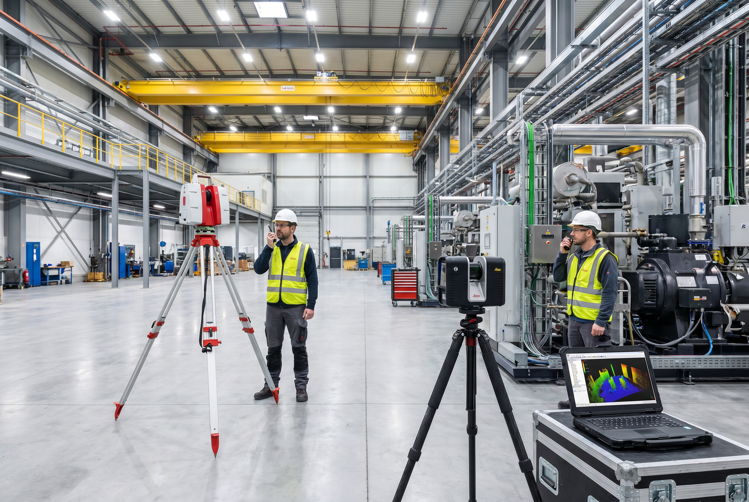
The most common equipment question from capital project managers evaluating Leica P50 industrial scanning programmes is whether the P50 or the LEICA RTC 360 is the right instrument for their facility. The honest answer for most large industrial projects is: both.
| Application | LEICA P50 | LEICA RTC 360 |
|---|---|---|
| Structural steel at height | ✅ Preferred — safe standoff | Limited above ~80m |
| Vessel exterior documentation | ✅ Preferred — 1km standoff | Adequate for smaller vessels |
| Enclosed mechanical room | Overkill — range unnecessary | ✅ Preferred — ±2mm, fast setup |
| High-density piping interior | Adequate | ✅ Preferred — 2,000,000 pts/sec |
| Open plant span >130m | ✅ Only viable option | ❌ 130m max range |
| MEP coordination deliverable | Adequate with post-processing | ✅ Preferred — ±2mm precision |
The LEICA RTC 360 delivers ±2mm accuracy at up to 130m range with a capture rate of 2,000,000 points per second — making it the optimal instrument for enclosed mechanical spaces, equipment rooms, and areas where maximum point density and sub-2mm precision are the controlling requirements. Where the RTC 360 reaches its range limit — or where safety clearances prevent close-approach scanning — the LEICA P50 takes over.
Robotic Imaging's industrial scanning deployments combine both instruments as a coordinated workflow: the LEICA P50 captures long-range structural and exterior data that establishes the plant's overall geometric framework, while the LEICA RTC 360 fills in high-density interior mechanical data at the precision level MEP engineering requires. This multi-scanner approach produces a unified, registered Point Cloud that no single instrument could deliver alone — and it is the workflow that industrial capital project teams operating at Fortune 500 scale require.
How a Long-Range Industrial Plant Scan Is Planned and Executed
Executing a Leica P50 industrial scanning programme requires a structured field methodology. The general workflow Robotic Imaging deploys for large plant documentation follows these phases:
Phase 1: Pre-Scan Site Assessment and Scan Plan Development
Before any equipment is mobilised, Robotic Imaging's project team reviews facility drawings, P&IDs, and site maps to develop a scan station plan. This defines the number of scanner positions required for complete coverage, identifies hazardous or restricted-access zones that require standoff scanning from the LEICA P50, and confirms access window timing for live plant operations. Station placement is optimised to maximise coverage overlap (required for registration) while minimising total station count — directly controlling field time and cost.
Phase 2: Field Capture — 2–3 Days
For most large industrial facilities, field capture using the LEICA P50 is completed in 2–3 days. Scanner positions are established using survey-grade control, with target arrays placed to support downstream registration. In live operating plants, scanning proceeds according to site-specific safety protocols — the LEICA P50 and LEICA RTC 360 are passive instruments that do not emit radiation, high-energy output, or electromagnetic interference that would affect process equipment. Where complex interior geometry or confined spaces are present, the LEICA BLK2GO mobile scanning system supplements tripod-based capture for corridors, pipe chases, and equipment bays inaccessible to stationary instruments.
Phase 3: Point Cloud Registration and QC
Captured scan data is registered in Autodesk ReCap Pro, aligning individual scan stations into a single unified coordinate system. Quality control checks confirm scan-to-scan registration accuracy across the entire dataset. For industrial facilities, registration QC is particularly critical — a misaligned point cloud propagates errors throughout the downstream Scan-to-BIM model and any clash detection analysis conducted in NavisWorks.
Phase 4: Deliverable Production and Final Delivery
Registered Point Cloud data is processed into client-specified deliverable formats — RCS, RCP, E57, LAS, LOD 300–350 Revit models, .DWG as-built drawings — and delivered within 10–14 business days of field capture completion. For industrial clients with multi-discipline engineering teams, coordinated deliverable packages that separate structural, mechanical, piping, and civil data into distinct worksets are available on request.
From Point Cloud to Plant Model: Deliverable Formats for Industrial Engineering
The Point Cloud produced by a LEICA P50 industrial scanning programme is only as valuable as its compatibility with the engineering software platforms the project team uses. Robotic Imaging delivers Leica P50 industrial scanning outputs in every format required by plant engineering workflows:
| Format | Compatible Software | Primary Use |
|---|---|---|
| RCS / RCP | Autodesk Revit, ReCap Pro, NavisWorks | BIM reference, clash detection |
| E57 | Universal — FARO Scene, Leica Cyclone, Bentley | Interoperability, archive |
| LAS / LAZ | GIS platforms, survey software | Survey-grade analysis, terrain |
| .RVT (Revit) | Autodesk Revit, BIM 360 | Scan-to-BIM model, multi-discipline coordination |
| .DWG / .DXF | AutoCAD, MicroStation | 2D as-built drawings, site plans |
For industrial engineering teams, the practical question is not just file format — it is whether the Point Cloud and BIM model are structured to support multi-discipline coordination. Robotic Imaging's industrial deliverables are produced with discipline-specific workset organisation, coordinate system alignment to site datums, and naming conventions consistent with the client's existing BIM execution plan. This eliminates the re-work that occurs when a point cloud delivered by a less experienced scanning firm requires hours of pre-processing before engineers can use it productively.
Scan-to-BIM for Industrial Facilities: LOD Standards and MEP Coordination
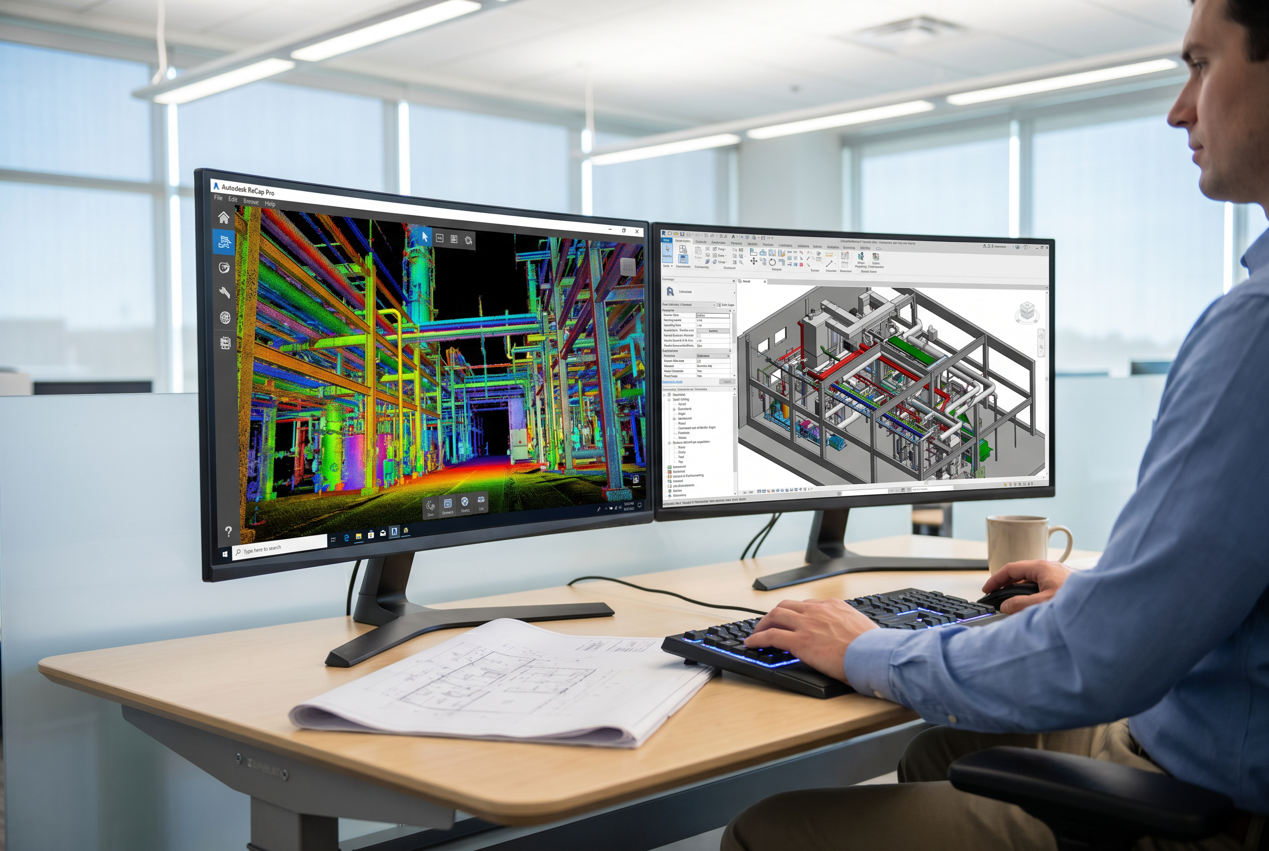
For industrial Scan-to-BIM programmes, Level of Development (LOD) specification is a critical procurement decision that directly affects the utility of the BIM model for downstream engineering tasks. Robotic Imaging delivers industrial Scan-to-BIM models at LOD 200 through LOD 400 depending on project requirements, with the following LOD tiers being most commonly specified for plant environments:
LOD 300 is the standard minimum for industrial as-built documentation. At LOD 300, structural members, vessels, major piping runs, and building elements are modelled with accurate geometry, dimensions, and spatial coordinates. This level is appropriate for facility planning, space allocation, brownfield retrofit studies, and capital project FEED phases where accurate existing-conditions data is required before engineering design begins.
LOD 350 adds interface and connection-level information — nozzle positions on vessels, pipe support locations, structural connection details, and equipment clearance data. This level is required for MEP coordination workflows and clash detection analysis in NavisWorks, where the interaction between new design elements and existing plant infrastructure must be verified to prevent costly field conflicts during construction or turnaround execution.
LOD 400 represents fabrication-level detail and is specified for individual components or systems where fabrication drawings will be derived directly from the model — spool fabrication, custom structural connections, or equipment replacement design.
For industrial capital projects, the combination of a LEICA P50 field capture programme and LOD 350 Scan-to-BIM deliverable from Robotic Imaging gives engineering teams a complete, coordination-ready model of existing plant conditions — eliminating the dimensional uncertainty that drives change orders during detailed engineering and construction phases. This is the core value proposition that differentiates a professionally executed industrial scanning programme from a basic Point Cloud capture service.
Industrial Laser Scanning Timeline and Pricing: What to Budget
For capital project managers building a business case for industrial laser scanning, two figures define the procurement conversation: timeline and cost.
Timeline: Field capture for most industrial scanning projects is completed in 2–3 days. Total project delivery — from field mobilisation through Point Cloud processing, registration, and final deliverable production — is 10–14 business days. This is 50–80% faster than traditional manual survey methods, which typically require separate site visits for dimensional verification, sketch capture, and survey control establishment, followed by weeks of office drafting. For scheduled plant turnarounds where engineering design must begin immediately after the maintenance window closes, Robotic Imaging's 10–14 business day delivery cycle is a project-critical capability. Large-scale multi-building campuses or facilities requiring multi-phase capture may require extended scheduling — Robotic Imaging's project team confirms programme timelines during scope development.
Pricing: Robotic Imaging's base scanning rate starts at $0.19 per square foot. Final project investment depends on facility size and geometry, total scan station count, deliverable specification (Point Cloud only vs full Scan-to-BIM), LOD requirement, and any site-specific access or safety requirements that affect field deployment logistics. Industrial facilities with extensive vertical infrastructure — tall structures, multi-level pipe racks, elevated equipment — require higher scan station densities than flat-floor commercial buildings, which affects total programme scope. For accurate project budgeting, contact Robotic Imaging directly with facility size, site description, and deliverable requirements to receive a project-specific quote.
Why Robotic Imaging for LEICA P50 Industrial Scanning Projects
The industrial laser scanning market includes equipment manufacturers, general surveying firms that occasionally deploy scanning instruments, and specialist scanning providers with varying levels of industrial deployment experience. For capital project managers evaluating vendors for a large plant scanning programme, the differentiators that matter are equipment capability, delivery reliability, data security, and proven industrial track record.
Robotic Imaging's position in this market is defined by several measurable factors that competing firms have not demonstrated at equivalent scale or technical depth.
No competitor in the scanning services market has published technical content or client evidence demonstrating P50 deployment capability for large industrial plants at the programme scale Robotic Imaging operates. Generic "industrial laser scanning" service listings without equipment specificity are a reliable indicator of limited long-range capability in the field. For a capital project team whose engineering design will be built on the accuracy of the as-built dataset, equipment specificity is not a technical footnote — it is a direct indicator of data quality.
Robotic Imaging's ISO 27001 and SOC 2 Type II certifications are directly relevant to industrial Fortune 500 clients whose plant data — including 3D models, P&IDs, and process asset documentation — carries confidentiality and security obligations. FAA Part 107 certification enables combined ground-plus-aerial documentation programmes where drone-captured data supplements the LEICA P50 Point Cloud for exterior structures, rooflines, and site-level context that tripod-based scanning cannot reach efficiently.
Why Industrial Teams Choose Robotic Imaging
- ✅ LEICA P50 in active fleet — 1km range, 1,000,000 pts/sec capture rate
- ✅ Multi-scanner workflow: LEICA P50 + LEICA RTC 360 + LEICA BLK2GO + DJI drone
- ✅ Survey-grade industrial Point Clouds → LOD 300–350 Scan-to-BIM
- ✅ 10–14 business day delivery from field capture to final deliverables
- ✅ $0.19/sq ft base scanning rate
- ✅ ISO 27001 + SOC 2 Type II — enterprise-grade data security
- ✅ FAA Part 107 certified for combined ground and aerial documentation
- ✅ Fortune 500 industrial client programmes across hundreds of sites
Frequently Asked Questions About LEICA P50 Industrial Scanning
What is the LEICA P50 used for in industrial settings?
The LEICA P50 is a long-range terrestrial laser scanner used to document large industrial facilities — including petrochemical plants, power generation sites, and heavy manufacturing environments. With a 1km range and 1,000,000-point-per-second capture rate, it captures structural steel, process vessels, piping, and overhead infrastructure from safe standoff distances, eliminating the need to reposition equipment in restricted-access or hazardous zones.
How does the LEICA P50 differ from the LEICA RTC 360 for plant scanning?
The LEICA P50 excels at long-range coverage — up to 1km — making it the preferred choice for open plant spans, tall structures, and exterior vessel documentation. The LEICA RTC 360 delivers ±2mm accuracy over up to 130m and is optimised for high-density interior scanning of mechanical rooms, equipment bays, and enclosed spaces. Most large industrial projects that Robotic Imaging executes deploy both scanners together as a coordinated workflow.
Can laser scanning be performed in a live operating plant?
Yes. Terrestrial laser scanners like the LEICA P50 are passive instruments — they emit a laser beam but do not require physical contact with equipment or structures. Scans can typically be performed during live operations, subject to site-specific safety protocols, hazardous area classifications, and facility access permissions. Scan planning should account for equipment movement, steam plumes, and airborne particulates that may affect data quality at certain positions.
What deliverable formats are produced from a LEICA P50 industrial scan?
LEICA P50 industrial scans processed by Robotic Imaging are delivered in industry-standard Point Cloud formats including RCS, RCP, E57, and LAS. These files are compatible with Autodesk Revit, AutoCAD, ReCap Pro, and NavisWorks. Final deliverables can include registered Point Clouds, LOD 300–350 Revit models (.RVT), 2D as-built drawings (.DWG, .DXF), and MEP documentation — all produced within a 10–14 business day total delivery window.
What LOD of BIM model is recommended for industrial plant as-builts?
For industrial plant as-built documentation, LOD 300 is the standard minimum — providing accurate geometry, dimensions, and spatial relationships for engineering design. LOD 350 adds interface and connection data, making it appropriate for MEP coordination and clash detection workflows in NavisWorks. LOD 400 is reserved for fabrication-level detail on specific components. Robotic Imaging delivers LOD 300–400 Scan-to-BIM models from industrial Point Cloud data depending on project specification.
How long does a LEICA P50 industrial scanning project take?
Field capture for most industrial scanning projects is completed in 2–3 days. Total project delivery — from field capture through Point Cloud processing and final Scan-to-BIM or CAD deliverables — is 10–14 business days. Large-scale facilities with complex geometry or multi-building campuses may require extended capture windows. Robotic Imaging's workflow is 50–80% faster than traditional manual surveying methods, making it the practical choice for time-constrained turnaround programmes.
What does LEICA P50 industrial scanning cost?
Robotic Imaging's base scanning rate starts at $0.19 per square foot. Final project pricing depends on facility size, complexity, number of scan stations required, deliverable type (Point Cloud only vs full Scan-to-BIM), and LOD specification. Industrial facilities with extensive vertical infrastructure, hazardous area access requirements, or multi-discipline BIM deliverables will affect total scope. Contact Robotic Imaging directly for a project-specific quote based on your facility parameters.
Does Robotic Imaging use the LEICA P50 for industrial projects?
Yes. The LEICA P50 is part of Robotic Imaging's active scanning fleet, deployed for large industrial facilities, long-range structural documentation, and engineering-grade surveys requiring 1km range and survey-grade accuracy. Robotic Imaging also holds ISO 27001 and SOC 2 Type II certifications, ensuring industrial clients' plant data — including sensitive P&IDs and 3D models — is handled with enterprise-grade security protocols throughout the project lifecycle.
Ready to Scope Your Industrial Scanning Programme?
Robotic Imaging's team of industrial scanning specialists will review your facility size, access constraints, and deliverable requirements to produce a project-specific scope, timeline, and quote — typically within one business day of your enquiry.
Get a Free Industrial Scanning QuoteAll pricing, delivery timelines, accuracy specifications, and client references reflect verified data from roboticimaging.com as of July 2026. Robotic Imaging is ISO 27001 certified and SOC 2 Type II compliant.