The As-Built Colorized LiDAR Point Cloud: New Applications for the Built World
Robotic ImagingApril 18, 2021
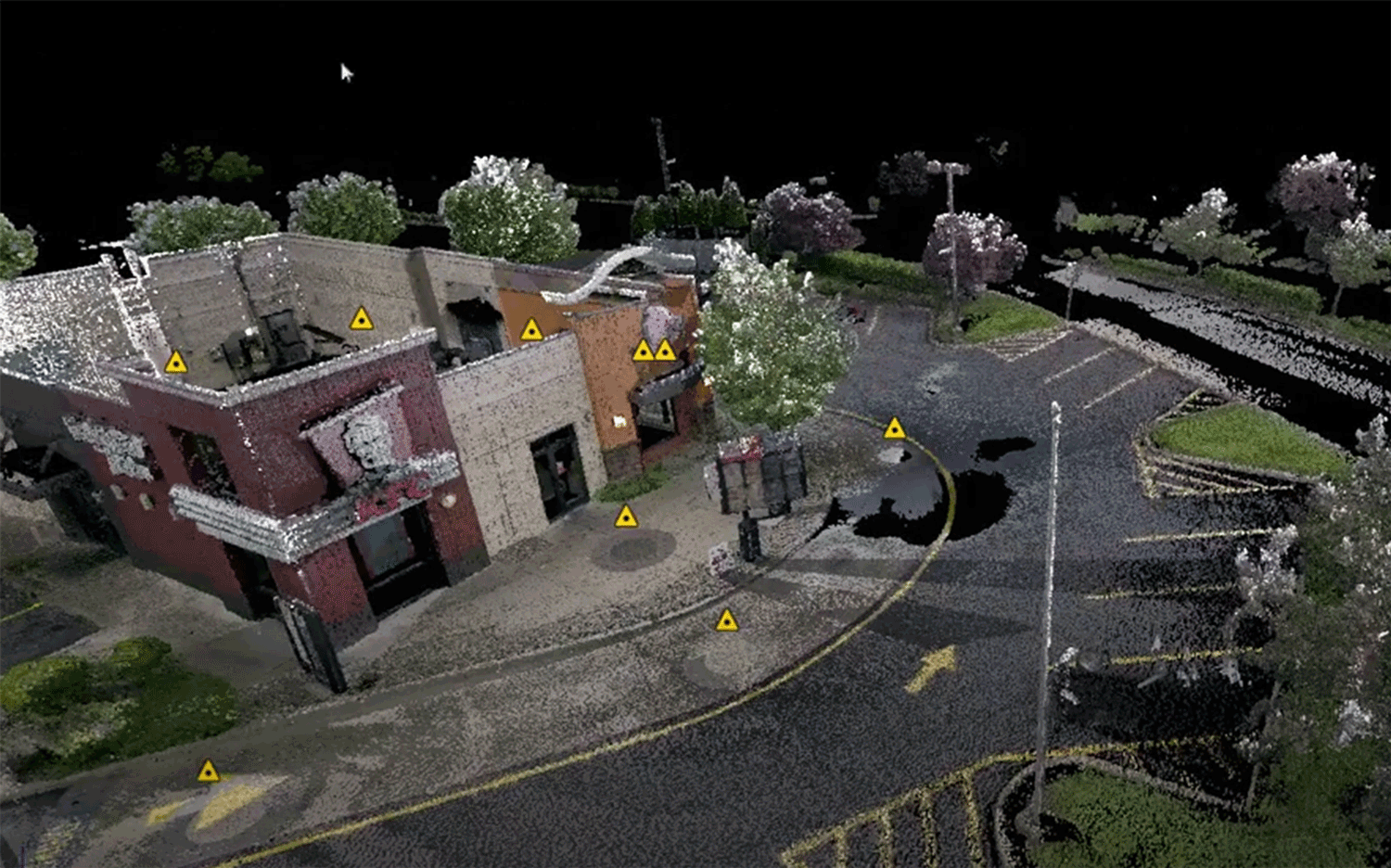
Digital copies of the world can be depicted in a variety of formats, but the most important file type we must focus on over the next 3 years is the As-Built Colorized LiDAR Point Cloud. When we say "As-Built" in Construction, it usually is accurate to the 1/8''. In Architecture, "As-Built" is usually to the 1/4''. LiDAR stands for Light Detection and Ranging. People use LiDAR sensors for projects that require the most accuracy. The general definition of a Point Cloud is a set of data points making up a 3D representation of the world with an XYZ coordinate for every pixel typically measured from lasers. When you add color to the point cloud, that is considered a 4D point cloud due to the RGB (Color) layer associated with each XYZ coordinate.
Indsutry Applications
In modern architecture, engineering and construction workflows, the As-Built Colorized LiDAR Point Cloud can be used as the true as-built basis or it can be used for quick important decision making. In the surveying or building industry, Point Clouds can be described as construction or design ready. In most common practice, Point Clouds are used by civil engineers to rapidly depict large topographies. In today's climate, Commercial Real Estate needs to find creative ways to fill or convert their space to residential, manufacturing, industrial, logistics, gig companies, urban farming, and regional development zoning. The fastest and most accurate way to convert this space, exterior or topography is by scanning and archiving a As-Built Colorized LiDAR Point Cloud.
Suggested reading: If you want to learn more about laser scanning's role in BIM, check out this article.
What is a Point Cloud
When you break down the Point Cloud's file structure, it is filled with XYZ values and RGB values (if it is colorized). This presents an exciting future of the built world and how it can be programmed, not only for sustainable, scalable and affordable development, but for passions like historical preservation and models of the world that can be archived and improved over time.
The future belongs to firms solving the problems that currently exist with the point cloud data usability. Some of the problems that come with managing point cloud data sets are:
- File sizes and having the proper computing
- Accuracy from field to cloud
- Design software compatibility
- Design expertise: designing from the point cloud
Mastering these 4 foundations will simplify applications like pre-construction, surveying, architecture, engineering, construction, sales, leasing and facilities management.