How Scan-to-BIM Services Expedite Historic Industrial Adaptive Reuse Projects
Robotic ImagingMarch 7, 2023
With historic preservation on the rise and adaptive reuse projects becoming more common, it's important for project owners to find ways to maximize efficiency. Scan-to-BIM services can help you do just that by providing a digital model of your building that allows architects and engineers to work from verified as-built information from the start. Not only does this save time and money during construction, but it also provides record maintenance documentation for future upgrades or adaptations to the space.
With the building already deemed a historic landmark, finding ways to design the project around existing structures and elements was important. Furthermore, there are several factors in historic buildings that affect how you design and build your site. Some of these include:
- The building's history—whether it was built in the 1800s, 1900s or even 1940s or 1950s.
- The materials used in its construction.
- The style of architecture (elements like arches, molding, columns, and so on).
In this blog post we'll focus on one particular aspect: how LiDAR scanning technology can be used to expedite adaptive reuse projects by allowing architects and engineers to see what they're building before they start digging holes or laying foundation blocks!
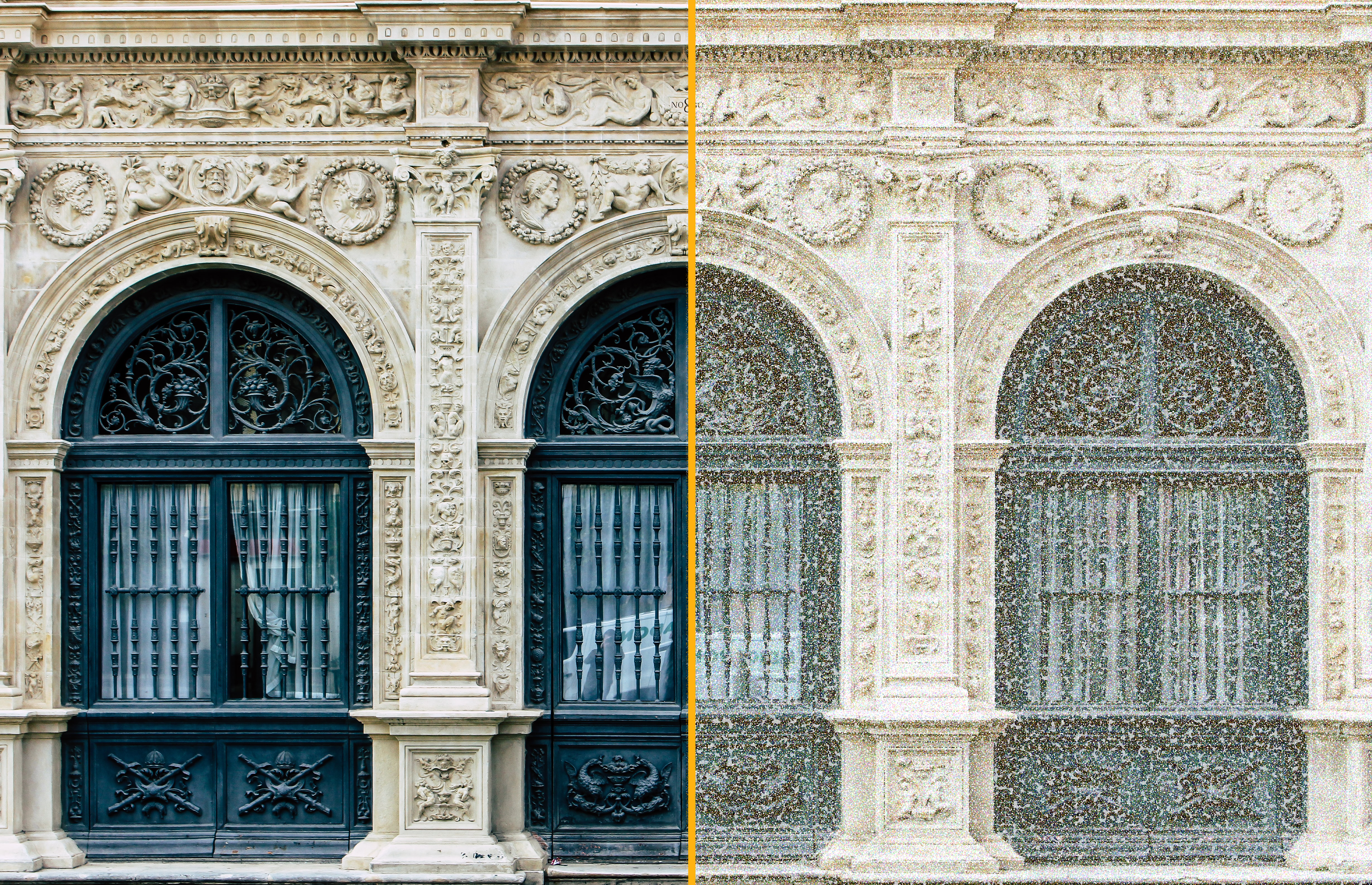
Since there are no construction drawings of historical buildings, we must create designs around existing elements and conditions. Laser scanning is the best, most-accurate, and fastest method of capturing existing conditions. Scanning allows you to plan future work more efficiently because it allows you to design around existing elements and conditions rather than building new structures based on assumptions about how things were built in the past. Scan-to-BIM services can assist you in creating a digital model that allows you to design and modify right on top of an accurate digital twin of the site. This is a more accurate way to design than working from old drawings, which can lead to costly errors or delays. Furthermore, older historic drawings never account for renovations that might have occured in these structures after it was first constructed.
We analyze point cloud data with survey grade accuracy through our proprietary suite of software including AutoCAD, Autodesk Revit, and Navisworks. These applications are used to create 3D models from the point cloud data. Once a model is created, it can be used to create construction drawings as well as modify the building's geometry for design purposes. Working from a scan-to-BIM model reduces rework and delays by allowing architects and engineers to work from verified as-built information from the start.
To accompany LiDAR scanning, at Robotic Imaging we also specialize in photogrammetry scanning. This means our high-tech scanner will take a series of photographs from multiple angles that assists in creating an accurate 3D model of the building. Photogrammetry and LiDAR technologies uses techniques such as triangulation or stereo vision to measure distance between points on an object by illuminating those points with cameras equipped with special lenses which cause light rays to form images when they pass through each other; these images are then combined into one complete picture using computer software programs like Autodesk ReCap Pro software suite developed by Autodesk.
Scanning allows us to capture an accurate representation of all existing conditions so that there are no surprises when it comes time for renovations or additions later down the road. LiDAR scanning can be used before the project begins, when you are ready to begin work on site, and throughout the entire process. LiDAR scans are created using high-resolution lasers that measure distances between points on earth in three dimensions (x, y and z). This information allows us to create detailed models of your property so that we can accurately plan out all aspects of your building or renovation project before construction begins and then again after construction is completed.
Scan-to-BIM services can be used to create a digital model that allows you to design and modify right on top of an accurate digital twin of the site. This means that you don't need to wait for surveys before starting work, which saves time and money—not only will it save you from having to hire extra people for this task, but also from having to deal with unforeseen issues while they're being surveyed. In addition, using scan-to-BIM services allows your project team members more freedom in how they want their designs executed; rather than relying solely on traditional survey methods (which may not always be accurate), they can use LiDAR as a tool in order generate accurate models quickly so that construction can begin sooner rather than later!
Using LiDAR and scan-to-BIM services during adaptive reuse projects can help save time, money, and headaches. And as you can see, there are many benefits to using LiDAR and scan-to-BIM services during adaptive reuse projects. If you are interested in learning more about how these tools can help your project, contact us today for a free quote!