45 posts tagged with "LiDAR"
View all posts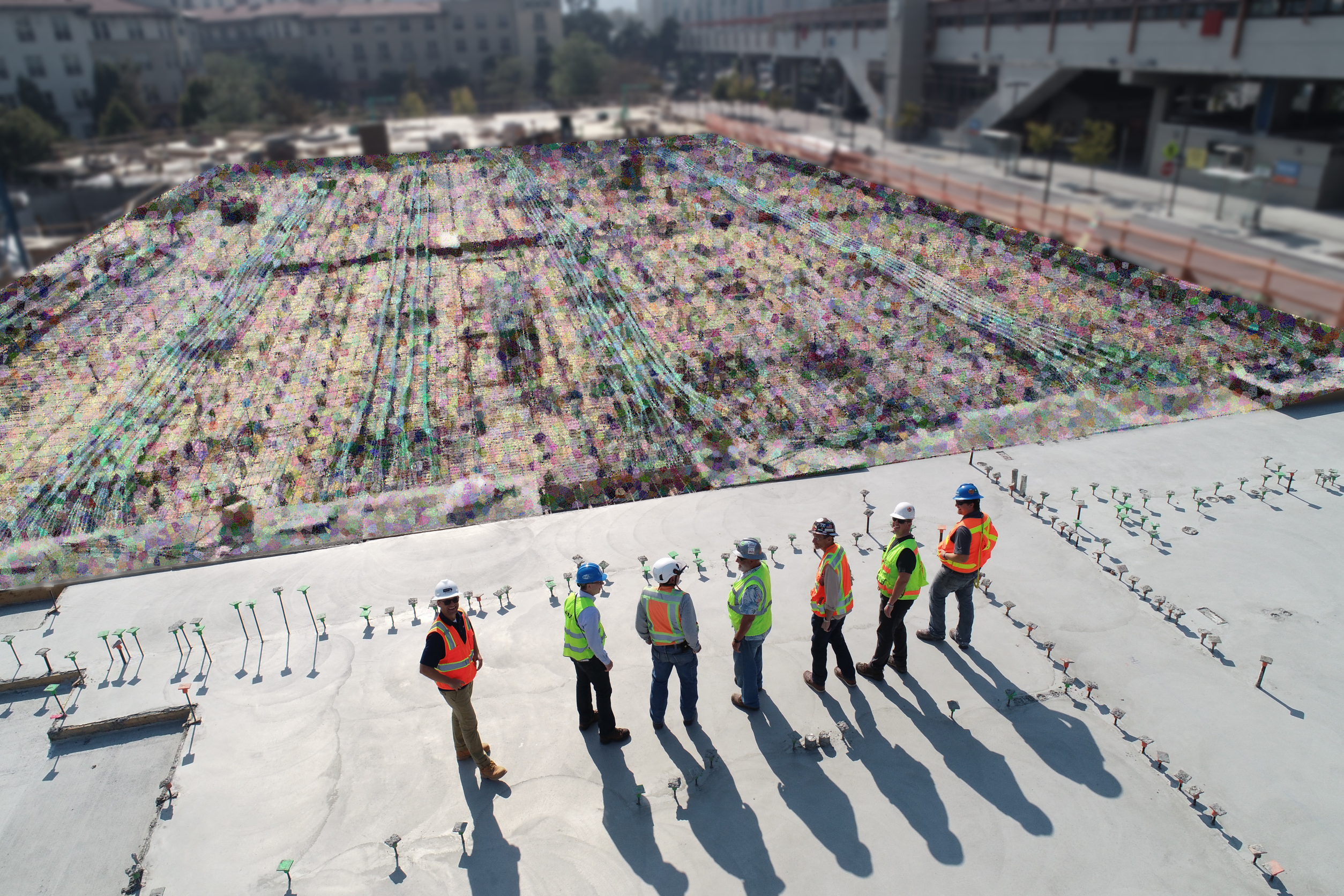
How Construction Sites Are Improved with LiDAR
Robotic Imaging, December 15, 2022
Tags:
Construction sites are a dangerous place to work. According to the U.S. Bureau of Labor Statistics, in 2020, the construction sector accounted for 165,300 injur...
LiDAR Scan Technology For Autonomous Vehicles
Robotic Imaging, December 13, 2022
Tags:
Have you heard about self-driving cars? Well, these cars are called autonomous vehicles, and as the name suggests, they can drive by themselves without the need...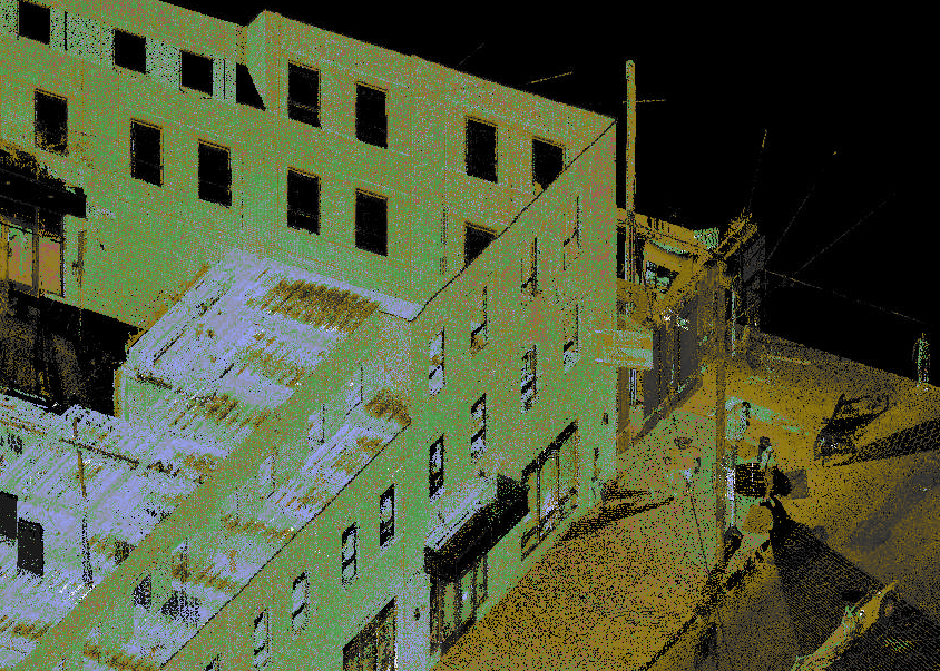
Why LiDAR Is the Most Important Step for Your Project
Robotic Imaging, December 4, 2022
Tags:
LiDAR scanning used for architectural and planning purposes has reimagined the planning, design, and construction of buildings worldwide. With this high technol...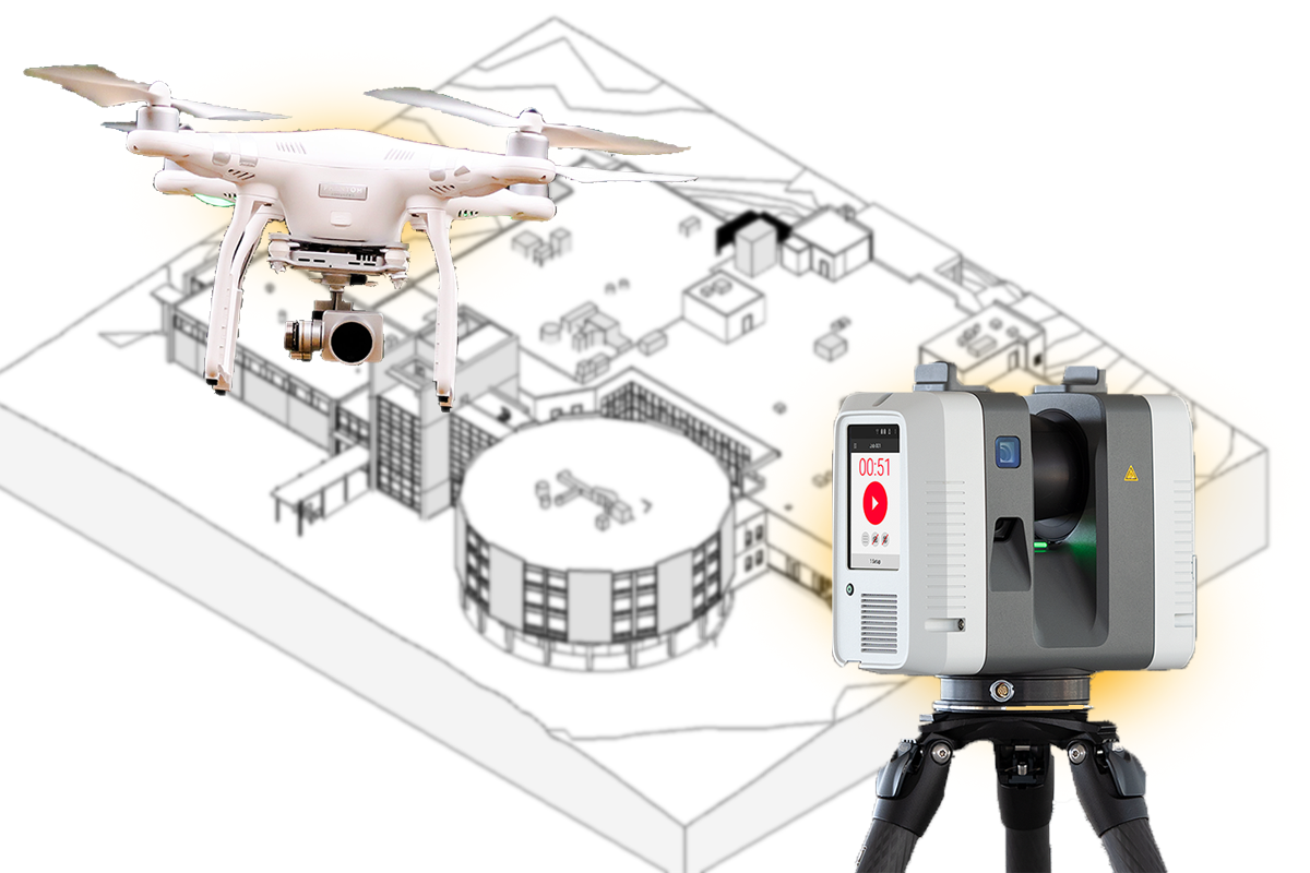
LiDAR Scan vs. Photogrammetry: Which One Is Best For Aerial Mapping?
Robotic Imaging, October 30, 2022
Tags:
There are primarily two main methods for gathering data for the purpose of aerial mapping. These include LiDAR scan and photogrammetry. The term "Lidar" stands...
How Can 3D Laser Scanning Help You?
Robotic Imaging, October 17, 2022
Tags:
Looking to save time, energy, and money? Here’s the ultimate scanning guide of everything you need to know about 3D laser scanning in construction. Every Archit...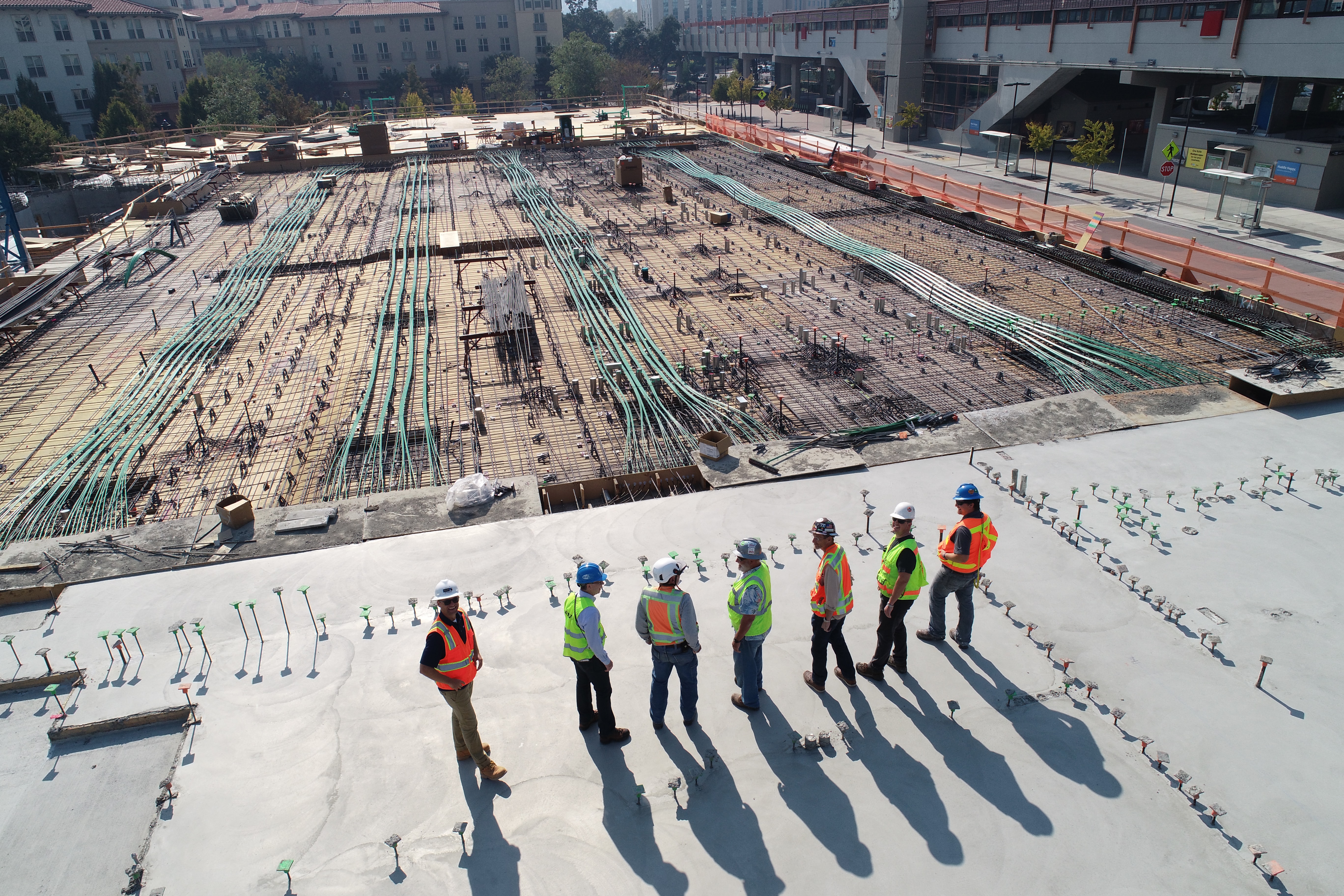
Reverse Engineering in 3D Laser Scanning
Robotic Imaging, October 9, 2022
Tags:
3D Laser Scan Utilization in Reverse Engineering – How it Works? Robotic Imaging has been providing 3D laser scan services for several years now and catering th...What Are the Top Construction Risks You Can Avoid with Laser Scan Services?
Robotic Imaging, October 3, 2022
Tags:
Construction managers and engineers know the importance of risk management at different stages of construction projects; otherwise, they have to deal with sever...The Utilization of 3D Laser Scanning in Industrial Plant Design
Robotic Imaging, September 25, 2022
Tags:
Designing and building industrial plants is one of the most hectic jobs for professionals because it requires high accuracy and absolute zero errors. With the t...